Тёщин язык
Location: Бурабай ауданы
Operator: Лесничество
GPS coordinates: 53.09833,70.25332
Latest update: November 30, 2024 20:08
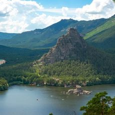
Burabay National Park
3.5 km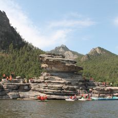
Zhumbaktas
1.2 km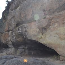
Kenesary Cave
4.4 km
Каменный трон
2 km
Каскад
2.8 km
Болектау
1.1 km
Жұмбақтас (Камень-загадка)
1.2 km
Scenic viewpoint
736 m
Дикий пляж
1.3 km
Observation deck
1.5 km
Scenic viewpoint
1.6 km
Пляж
1.6 km
Чёртова катушка
1.9 km
Scenic viewpoint
604 m
Поляна Аблай-хана
2 km
Мультимедийный интерактивный комплекс
2.1 km
Scenic viewpoint
845 m
Керемет жалпақ тас
2.9 km
World War 2 War memorial
3.1 km
World War 2 War Memorial
3.1 km
Waterfall
3.5 km
Scenic viewpoint
537 m
Zoo
3.9 km
Scenic viewpoint
4.3 km
Палаточный кемпинг Поющий полуостров
36 m
Khannin Kyzyl agashy
5.4 km
Scenic viewpoint
6.6 km
Scenic viewpoint
9.8 kmReviews
Visited this place? Tap the stars to rate it and share your experience / photos with the community! Try now! You can cancel it anytime.
Discover hidden gems everywhere you go!
From secret cafés to breathtaking viewpoints, skip the crowded tourist spots and find places that match your style. Our app makes it easy with voice search, smart filtering, route optimization, and insider tips from travelers worldwide. Download now for the complete mobile experience.

A unique approach to discovering new places❞
— Le Figaro
All the places worth exploring❞
— France Info
A tailor-made excursion in just a few clicks❞
— 20 Minutes