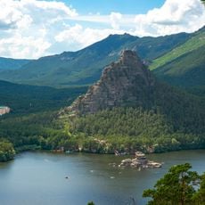
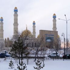
Zhumbaktas, Rock formation in Burabay National Park, Kazakhstan
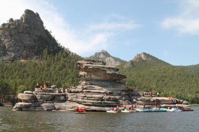
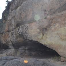
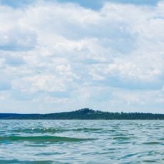
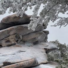
Zhumbaktas is a granite outcrop standing on the shore of Lake Borovoye, its outline shifting as you move around it. The surface bears smooth weathered sections alongside sharp angles, while pines grow at its base down to the water's edge.
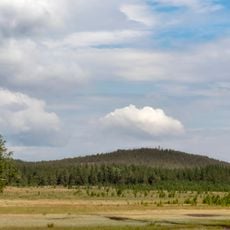
The formation received natural monument status in 2000 when Burabay National Park was established. This decision aimed to protect the geological features of the Kokshetau Upland region for future generations.
Local folklore connects the rock to traditional Kazakh tales, with its three distinct angles showing the transformation from a maiden to a mature woman to an elder.
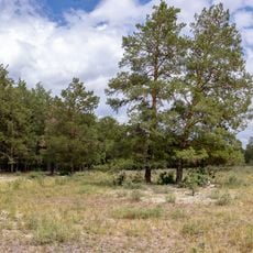
Marked paths lead from the main park area to the formation, with access easiest via flat shoreline sections. Early morning or late afternoon light brings out the contours most clearly and helps with orientation along the lake edge.
The shape of the formation changes visibly as you walk around it, revealing three different silhouettes from different viewpoints. This natural optical shift results from the asymmetric erosion of the granite over thousands of years.
Location: Burabay National Park
GPS coordinates: 53.08740,70.25200
Latest update: December 5, 2025 22:29
Burabay National Park
3.2 km
Ebeyty
199.8 km
Kokshetau National Park
121.6 km
Nauan Hazrat Mosque
62.3 km
Church of the Resurrection, Kokshetau
62.7 km
Kenesary Cave
3.2 km
Museum of History of Kokshetau
63.3 km
Kokshetau's Tatar Mosque
62.2 km
Church of the Holy Archangel Michael, Kokshetau
61.7 km
St George's Church, Kokshetau
63 km
City Park, Kokshetau
62.4 km
Church of St. Anthony of Padua, Kokshetau
63.3 km
Abylai Khan monument
62.2 km
Okzhetpes Stadium
61.5 km
Shoqan Walikhanov monument, Kokshetau
62.6 km
Akmola Regional Museum of History and Local Lore
62.1 km
Sileti Aūdany
197.5 km
Residential house and shop of merchant A. V. Sokolov
62.4 km
State Natural Monument "Relic pond"
59.3 km
Natural Monument "Raspberry cape"
79 km
State Natural Monument "Green cape"
79.1 km
Vladimir Lenin monument, Kokshetau
62.3 km
Natural Monument "Jackdaw hill"
61.2 km
Qyzyltū Aūdany
172.4 km
Natural Monument "Rock sediments "Pot""
130.9 km
State Natural Monument "Sharp hill «Helmet»"
57 km
Orlinogor State Nature Sanctuary (botanical)
140 km
State Natural Monument "Piceous hill"
79.9 kmReviews
Visited this place? Tap the stars to rate it and share your experience / photos with the community! Try now! You can cancel it anytime.
Discover hidden gems everywhere you go!
From secret cafés to breathtaking viewpoints, skip the crowded tourist spots and find places that match your style. Our app makes it easy with voice search, smart filtering, route optimization, and insider tips from travelers worldwide. Download now for the complete mobile experience.
A unique approach to discovering new places❞
— Le Figaro
All the places worth exploring❞
— France Info
A tailor-made excursion in just a few clicks❞
— 20 Minutes