Casuarina Sands Beach
Location: District of Stromlo
Website: https://www.parks.act.gov.au/find-a-park/murrumbidgee-river-corridor/casuarina-sands
Website: https://parks.act.gov.au/find-a-park/murrumbidgee-river-corridor/casuarina-sands
GPS coordinates: -35.31948,148.95269
Latest update: November 22, 2025 11:00
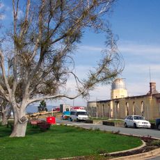
Mount Stromlo Observatory
5 km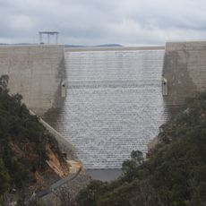
Cotter Dam
896 m
Mount Stromlo
5.3 km
Condor
4.7 km
Narrabundah Hill
6.6 km
Cotter Storage Reservoir
3 km
Uriarra State Forest
6.2 km
Mount Mc Donald
1.7 km
Black Hill
6.7 km
Murrays Hill
5.4 km
Brown Hill
3.1 km
Sugarloaf
4 km
Cotter Pumping Station and houses
324 m
ACT Bushfire Memorial
6.8 km
Mount Stromlo Observatory Precinct
4.9 km
Cotter Bridge
431 m
Ranger Hill
4.8 km
Flow
980 m
Sundial
5.2 km
Walking on the moon (2007)
5.2 km
Work of art
6.8 km
Scenic viewpoint
892 m
Dam Viewing Area
1.2 km
Lower Cotter Catchment lookout
1.3 km
Mount Stromlo Lookout
5.2 km
Scenic viewpoint
7.2 km
Old Trout Hatchery
904 m
The Willo Link
6 kmReviews
Visited this place? Tap the stars to rate it and share your experience / photos with the community! Try now! You can cancel it anytime.
Discover hidden gems everywhere you go!
From secret cafés to breathtaking viewpoints, skip the crowded tourist spots and find places that match your style. Our app makes it easy with voice search, smart filtering, route optimization, and insider tips from travelers worldwide. Download now for the complete mobile experience.

A unique approach to discovering new places❞
— Le Figaro
All the places worth exploring❞
— France Info
A tailor-made excursion in just a few clicks❞
— 20 Minutes