Plage des Meuniers
Location: La Chapelle-du-Mont-du-Chat
GPS coordinates: 45.72435,5.85587
Latest update: November 14, 2025 23:57

Lac du Bourget
1.3 km
Mont de la Charvaz
2.6 km
Maison forte de Monthoux
2.6 km
Bloc cupulaire de Santourin
2.6 km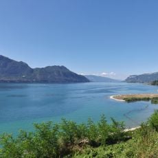
Lac du Bourget - marais de Chautagne
1.1 km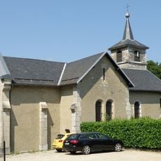
Église Saint-Antoine de La Chapelle-du-Mont-du-Chat
2 km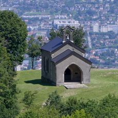
Chapelle Notre-Dame-de-l'Étoile de La Chapelle-du-Mont-du-Chat
2 km
Plateforme de Repos
1.8 km
Scenic viewpoint
2.6 km
Scenic viewpoint
2.2 km
Scenic viewpoint
2.5 km
Le Chamois
2 km
L'Eterlou
2.3 km
Plateforme de Vision
1.8 km
Point de vue
363 m
La Ronda
311 m
Scenic viewpoint
1.9 km
Scenic viewpoint
2.2 km
Scenic viewpoint
2 km
Scenic viewpoint
2.1 km
Parc de Brison
1.9 km
Plage de la pointe de l'Ardre
2 km
Work of art, statue
2.6 km
Panorama sur l'Avant-Pays Savoyard
2.4 km
Scenic viewpoint
1.8 km
Site archéologique de Grésine-est immergé dans le lac du Bourget
1.6 km
Site archéologique de Grésine-est immergé dans le lac du Bourget
1.7 km
Wayside cross
2.5 kmReviews
Visited this place? Tap the stars to rate it and share your experience / photos with the community! Try now! You can cancel it anytime.
Discover hidden gems everywhere you go!
From secret cafés to breathtaking viewpoints, skip the crowded tourist spots and find places that match your style. Our app makes it easy with voice search, smart filtering, route optimization, and insider tips from travelers worldwide. Download now for the complete mobile experience.

A unique approach to discovering new places❞
— Le Figaro
All the places worth exploring❞
— France Info
A tailor-made excursion in just a few clicks❞
— 20 Minutes