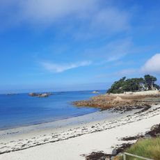
Plage du Laber
Location: France métropolitaine
GPS coordinates: 48.72021,-4.00660
Latest update: November 17, 2025 05:11
Plage de Perharidy
249 m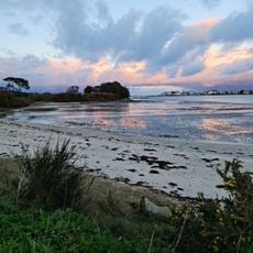
Beach of Pouldu
1.4 km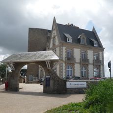
Villa Kerléna
1.3 km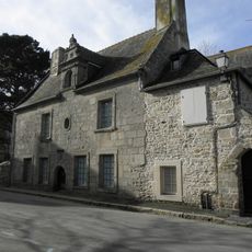
Maisons, 16-18 Rue Albert de Mun, Roscoff
1.6 km
Jardin Kerdilès
1 km
Maison des Johnnies et de l’oignon de Roscoff
1.4 km
Chapelle Saint-Nicolas de Roscoff
1.6 km
Ossuaries of Église Notre-Dame de Croaz Batz
1.7 km
Scenic viewpoint
840 m
Scenic viewpoint
786 m
Scenic viewpoint
813 m
Plage du Pouldu
1.2 km
Dorothée Silburne
1.7 km
Plage de Roc'h Kroum
1.1 km
Plage de Laber
1.1 km
Plage de Groa Rouz
1.2 km
Plage de Saint-Luc
1.1 km
HMCS Athabaskan
1.5 km
Jardin Louis Kerdiles
1.1 km
Louis Goarant
1.1 km
Plage des Cures
522 m
Tombe du Commonwealth Frank W. Stout
1.5 km
Ruins
811 m
Ruins
790 m
Ruins
783 m
Croix de Roskogoz
1.2 km
Memorial, war memorial
1.5 km
Christianity, Catholic church building, wayside cross
1.5 kmReviews
Visited this place? Tap the stars to rate it and share your experience / photos with the community! Try now! You can cancel it anytime.
Discover hidden gems everywhere you go!
From secret cafés to breathtaking viewpoints, skip the crowded tourist spots and find places that match your style. Our app makes it easy with voice search, smart filtering, route optimization, and insider tips from travelers worldwide. Download now for the complete mobile experience.

A unique approach to discovering new places❞
— Le Figaro
All the places worth exploring❞
— France Info
A tailor-made excursion in just a few clicks❞
— 20 Minutes