"Лагерський"
Location: Піщанська сільська громада
GPS coordinates: 49.19039,33.12522
Latest update: November 17, 2025 22:12
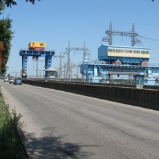
Kremenchuk Hydroelectric Power Plant
15.5 km
Kremenchuk Raion
18.7 km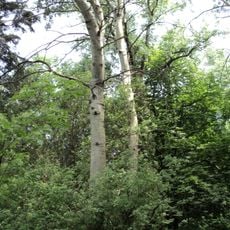
Ustymivskyi Arboretum
15 km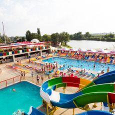
Polo City
23.2 km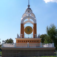
Гонг Миру
23.3 km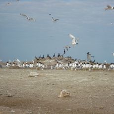
Ptashynyi Bazar
12.6 km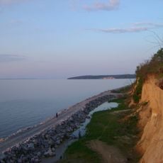
Svitlovodskyi Landscape Park
16 km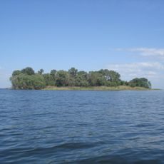
Ostriv Lysiachyi
16 km
Jewish Cemetery, Kremenchuk
23.4 km
Tsiupyna Balka
21.2 km
Світловодський міський краєзнавчий музей
16.8 km
Острів Обеліск
8.6 km
Svitlovodsk Palace of Culture
16.5 km
Зв'язківець
11.9 km
Scenic viewpoint
13.3 km
Гераський
5.2 km
"П'ятачок"
4.4 km
Пляж
15.9 km
Дитячий
16.3 km
Замок Андрусівка
16.7 km
Scenic viewpoint
361 m
Піраміда
16.2 km
Scenic viewpoint
3.1 km
Scenic viewpoint
960 m
Scenic viewpoint
17.7 km
Scenic viewpoint
15.4 km
Scenic viewpoint
11.7 km
Waterfall
21.4 kmReviews
Visited this place? Tap the stars to rate it and share your experience / photos with the community! Try now! You can cancel it anytime.
Discover hidden gems everywhere you go!
From secret cafés to breathtaking viewpoints, skip the crowded tourist spots and find places that match your style. Our app makes it easy with voice search, smart filtering, route optimization, and insider tips from travelers worldwide. Download now for the complete mobile experience.

A unique approach to discovering new places❞
— Le Figaro
All the places worth exploring❞
— France Info
A tailor-made excursion in just a few clicks❞
— 20 Minutes