Konjaku Nishimura
Location: 弁財天町
Location: 東山区
GPS coordinates: 35.00688,135.77273
Latest update: November 15, 2025 19:29

Rissei Garden Hulic Kyoto
252 m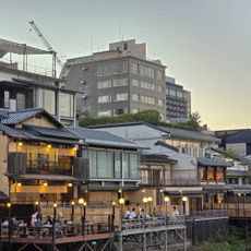
Kamo River Noryo-Yuka
212 m
火除け地蔵
220 m
せせらぎの道
92 m
Ponto-Cho Dori
155 m
せせらぎの道
54 m
土佐藩邸跡
216 m
陶匠青木聾米宅蹟
179 m
Wayside shrine, Buddhism
237 m
花の回廊
241 m
Wayside shrine
245 m
Wayside shrine
229 m
彦根藩邸跡
228 m
七之舟入址
214 m
先斗町歌舞練場
185 m
Old shop path
232 m
お龍 独身時代 寓居跡
206 m
なすあり地蔵菩薩
248 m
Wayside shrine
189 m
Wayside shrine, Buddhism
225 m
なすありの径
241 m
高瀬川保勝會
233 m
角倉了以翁顕彰碑
234 m
土木学会選奨土木遺産
235 m
Wayside shrine
238 m
Wayside shrine
205 m
Wayside shrine, Buddhism
243 m
Wayside shrine, Buddhism
249 mReviews
Visited this place? Tap the stars to rate it and share your experience / photos with the community! Try now! You can cancel it anytime.
Discover hidden gems everywhere you go!
From secret cafés to breathtaking viewpoints, skip the crowded tourist spots and find places that match your style. Our app makes it easy with voice search, smart filtering, route optimization, and insider tips from travelers worldwide. Download now for the complete mobile experience.

A unique approach to discovering new places❞
— Le Figaro
All the places worth exploring❞
— France Info
A tailor-made excursion in just a few clicks❞
— 20 Minutes