Flamin’ Hell
Location: Jingellic
Location: Snowy Valleys Council
Creator: Andrew Whitehead
Made from material: metal
Creator: Andrew Whitehead
GPS coordinates: -35.92632,147.69849
Latest update: November 22, 2025 16:16
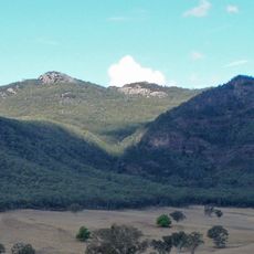
Pine Mountain
15.5 km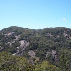
Burrowa - Pine Mountain National Park
19.5 km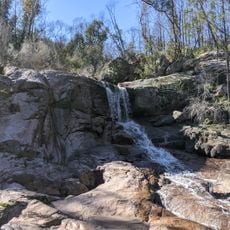
Woomargama National Park
20.8 km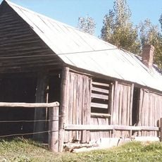
Coppabella Blacksmith Shop
20.5 km
Mundaroo State Forest
16.2 km
Mount Lawson
26.5 km
Hovell Crossing Weir
15.4 km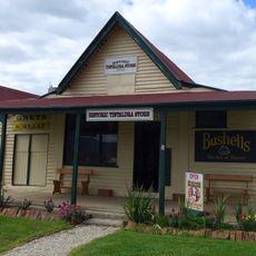
Tintaldra General Store
24.9 km
Bogong Moth
21.2 km
Scenic viewpoint
15.3 km
Rocky Knob
12.3 km
Pebble Beach
1 km
Wedge-tailed Eagle
11.8 km
Murray Cod
24.9 km
Welaregang Country Golf Club
25.2 km
Norths Lookout
26.8 km
Campbells Lookout
22.4 km
Walwa Golf Club
896 m
Mount Alfred Gap Lookout
11.8 km
Jim Newman Lookout
21.2 km
Scenic viewpoint
12.7 km
Scenic viewpoint
13.9 km
Scenic viewpoint
13.9 km
Monument
21.1 km
Avenue of Honours
24.8 km
Memorial
25 km
War memorial, memorial
5.5 km
Bluff Falls
22.4 kmReviews
Visited this place? Tap the stars to rate it and share your experience / photos with the community! Try now! You can cancel it anytime.
Discover hidden gems everywhere you go!
From secret cafés to breathtaking viewpoints, skip the crowded tourist spots and find places that match your style. Our app makes it easy with voice search, smart filtering, route optimization, and insider tips from travelers worldwide. Download now for the complete mobile experience.

A unique approach to discovering new places❞
— Le Figaro
All the places worth exploring❞
— France Info
A tailor-made excursion in just a few clicks❞
— 20 Minutes