Street Art Edithburgh Water Tower
Location: Edithburgh
Location: Yorke Peninsula Council
GPS coordinates: -35.08477,137.72576
Latest update: October 30, 2025 08:50
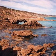
Emu Bay Shale
59.2 km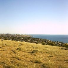
Port Stanvac, South Australia
65.7 km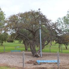
Old Mulberry Tree at Reeves Point
62.7 km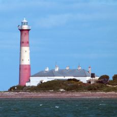
Troubridge Island Lighthouse
10 km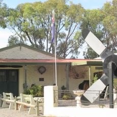
Bublacowie Military Museum
20.9 km
Hope Cottage-National Trust
63.1 km
Bublacowie Military Museum
20.9 km
Salmon Beach lookout
58.9 km
Pink Lake Viewing Area
13.7 km
Rapid bay jetty dive entrance
64.1 km
Kingscote Silo Art
63.6 km
Flagstaff Hill
62.7 km
Port Vincent Lookout
38.1 km
Scenic viewpoint
3.6 km
Historic Mulberry Tree
62.7 km
Port Julia Lookout
48.3 km
Scenic viewpoint
66.5 km
Scenic viewpoint
63 km
Kangaroo Island Brewery
65.2 km
Clan Ranald Anchor
1.9 km
Obelisk, memorial
1.7 km
No. 5
1.9 km
Monument
2 km
Memorial
36.9 km
Memorial, cannon
1.6 km
Captain Morgan's Prayer Nook
62.5 km
Reeves Point Jetty
62.4 km
Site of original Post Office
62.5 kmReviews
Visited this place? Tap the stars to rate it and share your experience / photos with the community! Try now! You can cancel it anytime.
Discover hidden gems everywhere you go!
From secret cafés to breathtaking viewpoints, skip the crowded tourist spots and find places that match your style. Our app makes it easy with voice search, smart filtering, route optimization, and insider tips from travelers worldwide. Download now for the complete mobile experience.

A unique approach to discovering new places❞
— Le Figaro
All the places worth exploring❞
— France Info
A tailor-made excursion in just a few clicks❞
— 20 Minutes