Du haut du Mont Saint-Aubert
Location: Mont-Saint-Aubert
Location: Tournai
Inception: January 1, 1971
Creator: Géo Libbrecht
GPS coordinates: 50.65500,3.39986
Latest update: November 19, 2025 20:06
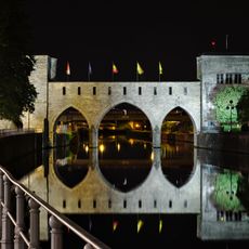
Bridge of the Holes
4.8 km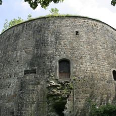
Henri VIII Tower
4.8 km
Esquelmes War Cemetery
4.1 km
Ramegnies-Chin Churchyard
4.6 km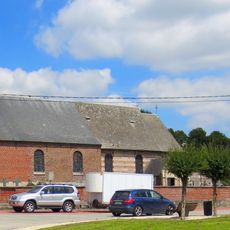
Église Sainte-Marie-Madeleine
4.7 km
Tomb
81 m
Tomb
77 m
Maison Art Nuveau
4.7 km
Croix Jubaru
504 m
Relais des artistes
5 m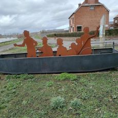
Les passeurs
3.7 km
Work of art
484 m
Memorial
2.3 km
Monument aux morts
2.6 km
Magic Parc
4.4 km
Tomb
79 m
Jungle City
4.1 km
Tomb
75 m
Tomb
75 m
Tomb
75 m
Tomb
75 m
Tomb
80 m
Catholic church building, wayside shrine
3.7 km
Cross of Sacrifice
4.1 km
Bolwerk
4.8 km
Anne Frank
4.7 km
Plaque commémorative résistants 40-45
4.7 km
Chapelle Murale de Tournai
4.6 kmVisited this place? Tap the stars to rate it and share your experience / photos with the community! Try now! You can cancel it anytime.
Discover hidden gems everywhere you go!
From secret cafés to breathtaking viewpoints, skip the crowded tourist spots and find places that match your style. Our app makes it easy with voice search, smart filtering, route optimization, and insider tips from travelers worldwide. Download now for the complete mobile experience.

A unique approach to discovering new places❞
— Le Figaro
All the places worth exploring❞
— France Info
A tailor-made excursion in just a few clicks❞
— 20 Minutes