
Svatý Jan Nepomucký
Location: Rozstání
Inception: January 1, 1938
GPS coordinates: 49.39754,16.83655
Latest update: November 11, 2025 21:02
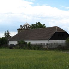
Windmill in Rozstání
965 m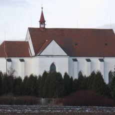
Church of the Nativity of the Virgin Mary
2.8 km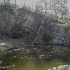
Černá skála (natural monument, Blansko District)
2.9 km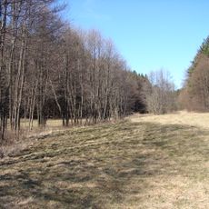
Studnické louky
3.3 km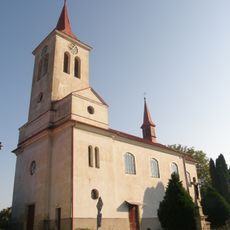
Church of Saint Michael
18 m
Socha sv. Jana Nepomuckého
2.8 km
Wayside shrine
1.6 km
Wayside cross
2.9 km
Wayside cross, Christianity
2.6 km
Wayside cross
6 m
Wayside cross
9 m
Memorial, war memorial
64 m
Wayside cross
411 m
Wayside shrine
1.6 km
ATC Baldovec
2.7 km
Wayside cross
3 km
Wayside cross
2.8 km
Scenic viewpoint
3.2 km
Wayside cross
1.9 km
Wayside cross
791 m
Wayside cross
3.2 km
Wayside cross
344 m
Wayside cross
761 m
Wayside shrine
1.5 km
Wayside cross
3 km
Memorial, war memorial
2.1 km
Wayside cross
2.5 km
Wayside cross
1.7 kmReviews
Visited this place? Tap the stars to rate it and share your experience / photos with the community! Try now! You can cancel it anytime.
Discover hidden gems everywhere you go!
From secret cafés to breathtaking viewpoints, skip the crowded tourist spots and find places that match your style. Our app makes it easy with voice search, smart filtering, route optimization, and insider tips from travelers worldwide. Download now for the complete mobile experience.

A unique approach to discovering new places❞
— Le Figaro
All the places worth exploring❞
— France Info
A tailor-made excursion in just a few clicks❞
— 20 Minutes