Taivalkoski South Trails Info
Location: Taivalkoski
Made from material: wood
GPS coordinates: 65.55279,28.15991
Latest update: October 25, 2025 00:02
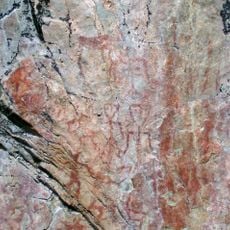
Värikallio rock paintings
52.8 km
Syöte National Park
24.5 km
Kallioniemi
20 km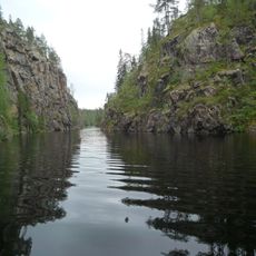
Julma-Ölkyn kalliomaalaus
53.8 km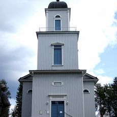
Taivalkoski Church
4.4 km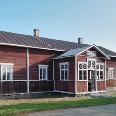
Posio Local History Museum
59.3 km
Mustaperän kivikautinen talo
32.3 km
Transmitter mast, Observation tower, pole, scenic viewpoint, Mobile light tower
26.8 km
Bird Viewing Point
20.8 km
Peikkopolku
21.4 km
Hossa Visitor Centre
63.4 km
Anu Pentik Galleria
62.4 km
Work of art
5.4 km
Work of art
62.2 km
Soiperoinen
14.9 km
Pyhitys
27.4 km
Taivalvaara
2.3 km
Ahmakallio
32.2 km
Jumalanhauta, hiidenkirnu
47.9 km
Bird Viewing
19.8 km
Scenic viewpoint
26.9 km
Tower, Observation tower, scenic viewpoint
60.8 km
Mobile light tower, tower, Observation tower, bird hide, scenic viewpoint
34.5 km
Scenic viewpoint, Mobile light tower, tower, Observation tower, bird hide
58.9 km
Scenic viewpoint
52.9 km
Pahkakuru
5.4 km
Scenic viewpoint
26.8 km
Näköalapaikka
52.9 kmReviews
Visited this place? Tap the stars to rate it and share your experience / photos with the community! Try now! You can cancel it anytime.
Discover hidden gems everywhere you go!
From secret cafés to breathtaking viewpoints, skip the crowded tourist spots and find places that match your style. Our app makes it easy with voice search, smart filtering, route optimization, and insider tips from travelers worldwide. Download now for the complete mobile experience.

A unique approach to discovering new places❞
— Le Figaro
All the places worth exploring❞
— France Info
A tailor-made excursion in just a few clicks❞
— 20 Minutes