Le Meunier
Location: Vouharte
Creator: Adrien Meneau
Made from material: wood
Creator: Adrien Meneau
GPS coordinates: 45.81546,0.07193
Latest update: November 15, 2025 21:50
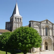
Abbaye de Saint-Amant-de-Boixe
5.3 km
Château de Montignac
5.3 km
Logis de Lugérat
3.7 km
Commanderie du Fouilloux
1.8 km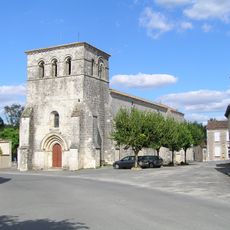
Église Saint-Pierre-des-Martyrs
4 km
Église Notre-Dame de Coulonges
2.4 km
Église Notre-Dame de Xambes
2.9 km
Espace d'Architecture Romane
5.2 km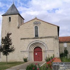
Église Saint-Étienne d'Ambérac
4 km
Église Notre-Dame de Vouharte
139 m
Église Saint-Georges de Vervant
4.7 km
Abbatiale Saint-Amant de Saint-Amant-de-Boixe
5.3 km
Église Saint-Vincent de La Chapelle
3.8 km
Chapelle Saint-Mathurin de Chebrac
4.6 km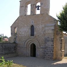
Église Saint-Martin de Bignac
2.2 km
Charente Médiane Viaduct
4.3 km
La Lavandière
300 m
Renault 4
692 m
Renault 4
821 m
Monument aux Morts
5.3 km
Memorial
2.9 km
Calvaire
4.4 km
Memorial, war memorial
4.1 km
Monument aux Morts
4.1 km
Catholic church building, wayside cross, Christianity
2.5 km
Stele, memorial
2.1 km
Memorial, war memorial
5.2 km
Wayside cross
3.6 kmReviews
Visited this place? Tap the stars to rate it and share your experience / photos with the community! Try now! You can cancel it anytime.
Discover hidden gems everywhere you go!
From secret cafés to breathtaking viewpoints, skip the crowded tourist spots and find places that match your style. Our app makes it easy with voice search, smart filtering, route optimization, and insider tips from travelers worldwide. Download now for the complete mobile experience.

A unique approach to discovering new places❞
— Le Figaro
All the places worth exploring❞
— France Info
A tailor-made excursion in just a few clicks❞
— 20 Minutes