1941-1945
Location: ჩოხატაურის მუნიციპალიტეტი
GPS coordinates: 41.99130,42.22526
Latest update: November 18, 2025 17:32
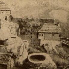
Askana Fortress
7.9 km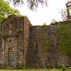
Aketi Church of the Saviour
14.6 km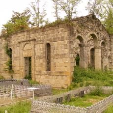
Aketi Church of Saint George
14.5 km
Დვაბზუს „უსახელო“ ბაზილიკა
15.2 km
Ნაბეღლავი
13.7 km
Ფილიპე მახარაძის სახლი
15 km
Flammable well
14.5 km
Erketi Monastery
4.1 km
Udabno Monastery
7.5 km
Sunset Beach
2.5 km
Mosaic, Work of art
2.5 km
Mosaic, Work of art
14.3 km
Relief sculpture, Work of art
10.4 km
Scenic viewpoint
15.2 km
Tea plantation GreenGold
8.3 km
GeenGold Tea Plantation
8 km
Scenic viewpoint
7.9 km
Wayside cross
2.5 km
1941-1945
2.5 km
Მამული ენა სარწხმემოება
3.1 km
Გურიის ერისთავების ციხე-დარბაზი
2.4 km
Ნიკო ბენდელიანი
2.2 km
Gamochinebuli
11.9 km
Სიმონა დოლიძის ძეგლი
5.1 km
Memorial
10.4 km
Waterfall
3.1 km
Ჩანჩქერი მდ.ოჩოჩხეზე
8.2 km
Waterfall
10.2 kmReviews
Visited this place? Tap the stars to rate it and share your experience / photos with the community! Try now! You can cancel it anytime.
Discover hidden gems everywhere you go!
From secret cafés to breathtaking viewpoints, skip the crowded tourist spots and find places that match your style. Our app makes it easy with voice search, smart filtering, route optimization, and insider tips from travelers worldwide. Download now for the complete mobile experience.

A unique approach to discovering new places❞
— Le Figaro
All the places worth exploring❞
— France Info
A tailor-made excursion in just a few clicks❞
— 20 Minutes