St. Martin
Location: Tönisvorst
Inception: January 1, 1994
Creator: Loni Kreuder
Creator: Loni Kreuder
GPS coordinates: 51.32090,6.49164
Latest update: July 20, 2025 15:48

H2Oh!
771 m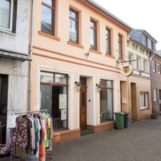
Heimathaus Antonius
93 m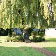
Jüdischer Friedhof in St. Tönis
1.5 km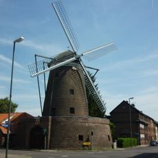
Streuff-Mühle
421 m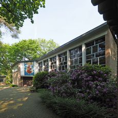
Johanneskirche
2.4 km
St. Mariä-Heimsuchung
2.8 km
Erlöserkirche Lindenthal
3.2 km
LSG-Oberbenrad-Forstwald
2.9 km
St. Michael Lindenthal
2.8 km
LSG-Anrather Bach/Kehn
3 km
Catholic church building, wayside cross, Christianity
577 m
Fußfallstation V
473 m
Fußfallstation VII
571 m
Catholic church building, wayside cross, Christianity
537 m
Fußfallstation IV
747 m
Mausoleum, tomb
486 m
Fußfallstation III
833 m
Fußfallstation II
906 m
Bildstock mit Pieta
1.3 km
Fußfallstation VI
565 m
Wayside cross
1.6 km
Catholic church building, wayside cross, Christianity
2 km
Catholic church building, wayside cross, Christianity
2 km
Fußfallstation I
455 m
Streuffmühle
434 m
GeschichtsLandschaften Station 11
402 m
Antonius-Denkmal
115 m
Grabstein
56 mReviews
Visited this place? Tap the stars to rate it and share your experience / photos with the community! Try now! You can cancel it anytime.
Discover hidden gems everywhere you go!
From secret cafés to breathtaking viewpoints, skip the crowded tourist spots and find places that match your style. Our app makes it easy with voice search, smart filtering, route optimization, and insider tips from travelers worldwide. Download now for the complete mobile experience.

A unique approach to discovering new places❞
— Le Figaro
All the places worth exploring❞
— France Info
A tailor-made excursion in just a few clicks❞
— 20 Minutes