Rotes Kreuz
Location: Ludwigshafen-Nördliche Innenstadt
Location: Ludwigshafen am Rhein
GPS coordinates: 49.48507,8.41515
Latest update: November 23, 2025 23:44
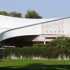
Friedrich-Ebert-Halle
723 m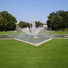
Ebertpark
465 m
Main cemetery Ludwigshafen am Rhein
590 m
Gemeinschafts-Müllheizkraftwerk Ludwigshafen
881 m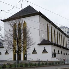
St. Marienkirche
1.1 km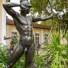
Archer
409 m
Helene Rummer
1.1 km
Ruth Silberberg
1 km
Ring des Seyns
819 m
Work of art
1 km
Work of art, sculpture
773 m
Memorial
923 m
Franz Kayser
816 m
Jakob Rummer
1.1 km
Naturfreibad Blies
1.1 km
Dina Berner
696 m
Dr. Otto F. Meyer
696 m
Ehemaliger Wasserturm
910 m
Frieda Groll
1 km
Hermine Eleonore Meyer
889 m
Dorothea Schuster
891 m
Dr. Marie Regina Schuster
894 m
Dr. Curt Schuster
897 m
Dr. Siegfried Rothenberg
1.1 km
Dr. Edgar Strauss
1.1 km
Edgar Hoecker
1.1 km
Peter Hoecker
1.1 km
Alma Hoecker
1.1 kmReviews
Visited this place? Tap the stars to rate it and share your experience / photos with the community! Try now! You can cancel it anytime.
Discover hidden gems everywhere you go!
From secret cafés to breathtaking viewpoints, skip the crowded tourist spots and find places that match your style. Our app makes it easy with voice search, smart filtering, route optimization, and insider tips from travelers worldwide. Download now for the complete mobile experience.

A unique approach to discovering new places❞
— Le Figaro
All the places worth exploring❞
— France Info
A tailor-made excursion in just a few clicks❞
— 20 Minutes