Luft
Location: Serrig
Creator: Igor Michailow
Creator: Igor Michailow
GPS coordinates: 49.58179,6.56805
Latest update: November 20, 2025 01:09
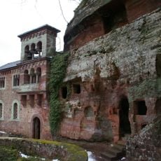
Klause Kastel
1.5 km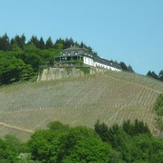
Weingut Schloss Saarstein
417 m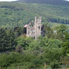
Weingut Schloss Saarfels
842 m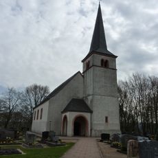
St. Johannes der Täufer (Kastel-Staadt)
1.6 km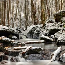
Serriger Bachtal und Leuk und Saar
1.6 km
Scenic viewpoint
1.4 km
Scenic viewpoint
1.6 km
Römertor
1.4 km
Klause Kastel Staadt
1.5 km
Bleistiftmikado
1.6 km
Work of art, sculpture
1.4 km
Scenic viewpoint
821 m
Dead end street, scenic viewpoint
1.5 km
Scenic viewpoint
1.4 km
Hubertusquelle
1.3 km
Scenic viewpoint
1.5 km
Wassertretbecken
1.3 km
Scenic viewpoint
1.5 km
Scenic viewpoint
1.6 km
Memorial, Obelisk
1.4 km
Witzelstein
958 m
Catholic church building, place of worship, wayside shrine, Christianity, house of prayer
480 m
Catholic church building, wayside cross, Christianity
1.6 km
Christoph
951 m
Catholic church building, wayside cross, Christianity
857 m
Rock-cut tomb, tomb
1.5 km
Memorial, commemorative plaque
1.5 km
Wayside cross, Christianity, house of prayer, place of worship
800 mReviews
Visited this place? Tap the stars to rate it and share your experience / photos with the community! Try now! You can cancel it anytime.
Discover hidden gems everywhere you go!
From secret cafés to breathtaking viewpoints, skip the crowded tourist spots and find places that match your style. Our app makes it easy with voice search, smart filtering, route optimization, and insider tips from travelers worldwide. Download now for the complete mobile experience.

A unique approach to discovering new places❞
— Le Figaro
All the places worth exploring❞
— France Info
A tailor-made excursion in just a few clicks❞
— 20 Minutes