Tien Anton
Location: Viersen
Creator: Hubert Lönecke
Creator: Hubert Lönecke
GPS coordinates: 51.25208,6.33363
Latest update: November 21, 2025 19:13
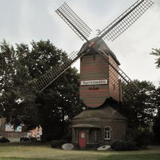
Narrenmühle
667 m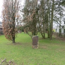
Jüdischer Friedhof Dülken
1 km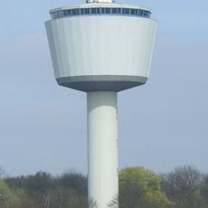
Wasserturm Dülken
1.3 km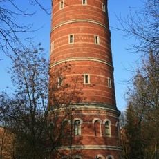
Alter Wasserturm Dülken
452 m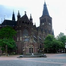
St. Cornelius
125 m
Kriegerdenkmal Dülken
355 m
Kriegerdenkmal Sektion Busch
1.2 km
Ente
59 m
Huhn
61 m
Schwein
64 m
Stadtmodell
358 m
Memorial
87 m
Christianity, Catholic church building, wayside cross
678 m
Catholic church building, wayside cross, Christianity
609 m
Blaubeermuffinbaum
43 m
Kaiser-Wilhelm-Denkmal
180 m
Vier Winde Brunnen
112 m
Catholic church building, wayside shrine, Christianity
1.4 km
Wir mahnen
365 m
Gedenkstein an die jüdische Gemeinde
251 m
Bildstock Ransberg 18
1.3 km
Mariensäule
117 m
Kreuz des Ostens
1.4 km
Grabstätte der Familie Tonnar
1.1 km
Grabstätte Familie Gatzenmeier/Schmitz
1.1 km
Grabmal der Familie Specken
1.2 km
Grabstätten der Fam. Kroll, der Fam. Cornely Middeldorf und Pfarrer der St. Cornelius Pfarre Dülken
1.2 km
Bildstock Ransberg 14
1.2 kmReviews
Visited this place? Tap the stars to rate it and share your experience / photos with the community! Try now! You can cancel it anytime.
Discover hidden gems everywhere you go!
From secret cafés to breathtaking viewpoints, skip the crowded tourist spots and find places that match your style. Our app makes it easy with voice search, smart filtering, route optimization, and insider tips from travelers worldwide. Download now for the complete mobile experience.

A unique approach to discovering new places❞
— Le Figaro
All the places worth exploring❞
— France Info
A tailor-made excursion in just a few clicks❞
— 20 Minutes