Zeitzeichen
Location: Mechernich
Inception: October 1, 2016
Creator: Günter Preuss
Creator: Günter Preuss
GPS coordinates: 50.59203,6.63756
Latest update: November 20, 2025 00:04
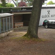
Mechernich Mining Museum
1 km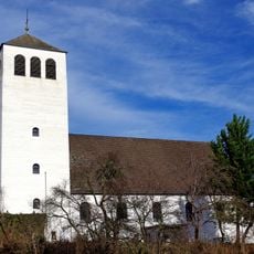
St. John Baptist (Mechernich)
1.2 km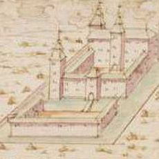
Haus Rath
1.2 km
Bleibachtal bei Roggendorf und Strempter Heide
426 m
Krebsbachtal bei Roggendorf
952 m
Griesberg und ehemalige Abbbaubereiche bei Kommern
667 m
Griesberg
656 m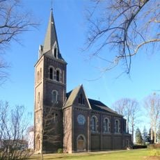
Evangelische Kirche (Mechernich-Roggendorf)
753 m
Blühendes Mechernich
542 m
Silberne Bergwerkslore auf Schienenstück, in der Mitte befindet sich ein großer Steinklotz
1.3 km
Lok und Lore
867 m
Stadtwappen Partnerstadt Skarszewy
545 m
Stadtwappen Partnerstadt Nyons
543 m
Stadtwappen Mechernich
540 m
Sommerrodelbahn
1 km
Meine Stadt
1.1 km
Work of art, sculpture
1.2 km
Quad-Parcour
982 m
Statue, Work of art
357 m
Memorial
905 m
Wayside cross, Christianity
1.1 km
Wayside cross, summit cross, Christian cross, Christianity, Catholic church building, monumental cross
1.3 km
Catholic church building, wayside shrine, Christianity
1.1 km
Wayside cross, Christianity
547 m
Memorial
540 m
Monument
916 m
Stele, memorial
1 km
Stele, memorial
1.3 kmReviews
Visited this place? Tap the stars to rate it and share your experience / photos with the community! Try now! You can cancel it anytime.
Discover hidden gems everywhere you go!
From secret cafés to breathtaking viewpoints, skip the crowded tourist spots and find places that match your style. Our app makes it easy with voice search, smart filtering, route optimization, and insider tips from travelers worldwide. Download now for the complete mobile experience.

A unique approach to discovering new places❞
— Le Figaro
All the places worth exploring❞
— France Info
A tailor-made excursion in just a few clicks❞
— 20 Minutes