Eule
Location: Koblenz
Made from material: wood
GPS coordinates: 50.31042,7.55795
Latest update: November 22, 2025 08:38
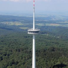
Fernmeldeturm Koblenz
846 m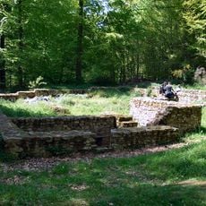
Confluentes
1.2 km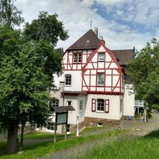
Remstecken
778 m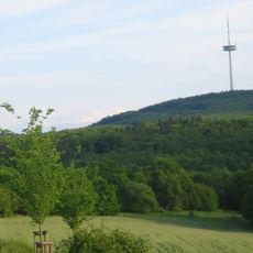
Kühkopf
863 m
Loß-Kopf
886 m
Ein Wirtschaftsgebäude der römischen Villa am Remstecken
959 m
Aussicht Kühkopf
678 m
Wildgehege Damwild
870 m
Wildgehege Wildschweine
977 m
Wildgehege Sikawild & Nandus
1.1 km
Wildgehege Damwild
686 m
Wildschweine
1.1 km
Wildgehege Sikahirsch
1.2 km
Römische Villa (Typ: Villa Rustica)
989 m
Wildgehege Rotwild
896 m
Basaltsäulen
963 m
Volieren (Wald Kids Station 9)
785 m
Am Layer Berg
1.1 km
Johanniskreuz
1.1 km
Soldatengrab
997 m
Bäckerskreuz
1.3 km
Ancient Rome, tourist attraction, archaeological site
780 m
Ancient Rome, tourist attraction, archaeological site
791 m
Tourist attraction, archaeological site
610 m
Tourist attraction, archaeological site
858 m
Archaeological site
356 m
Archaeological site
536 m
Archaeological site
595 mReviews
Visited this place? Tap the stars to rate it and share your experience / photos with the community! Try now! You can cancel it anytime.
Discover hidden gems everywhere you go!
From secret cafés to breathtaking viewpoints, skip the crowded tourist spots and find places that match your style. Our app makes it easy with voice search, smart filtering, route optimization, and insider tips from travelers worldwide. Download now for the complete mobile experience.

A unique approach to discovering new places❞
— Le Figaro
All the places worth exploring❞
— France Info
A tailor-made excursion in just a few clicks❞
— 20 Minutes