Correct place of historic border stone
Location: Grefrath
Made from material: wood
GPS coordinates: 51.37925,6.35814
Latest update: November 10, 2025 14:04

Abtei Mariendonk
294 m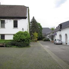
Neersdommer Mühle
129 m
Vorster Mühle
1.8 km
Schlootkuhlen
2.7 km
Grasheide und Mühlhausener Benden
1.9 km
Altbuchen an Harbes Hof
1.2 km
Vorster Feld
530 m
LSG-Landgraben
452 m
Netteniederung
2.6 km
Schleck
2.2 km
LSG-Vorster Heide
2 km
Kriegergedächtniskapelle u. Hl. Brigida
2 km
Nette bei Vinkrath
2.3 km
Schlootkuhlen
2.5 km
Netteniederung
1.7 km
Bootsverleih Waerdt
2.6 km
Maislabyrinth
2.6 km
Scenic viewpoint
903 m
Gleumes Kreuz
2.4 km
Wegekreuz
2.4 km
Place of worship, wayside shrine, Christianity, house of prayer, Catholic church building
2.1 km
Wayside cross, Christianity, Catholic church building
1.8 km
Wayside shrine
941 m
Wayside cross
1.4 km
Catholic church building, wayside cross, Christianity
2.1 km
Haefs-Kreuz
2.6 km
Willmen-Kreuz
2.4 km
Pilgerkreuz
1.2 kmReviews
Visited this place? Tap the stars to rate it and share your experience / photos with the community! Try now! You can cancel it anytime.
Discover hidden gems everywhere you go!
From secret cafés to breathtaking viewpoints, skip the crowded tourist spots and find places that match your style. Our app makes it easy with voice search, smart filtering, route optimization, and insider tips from travelers worldwide. Download now for the complete mobile experience.

A unique approach to discovering new places❞
— Le Figaro
All the places worth exploring❞
— France Info
A tailor-made excursion in just a few clicks❞
— 20 Minutes