Les fondations du ciel
Location: Bad Rothenfelde
Inception: June 29, 2006
Creator: Louis Chacallis
Creator: Louis Chacallis
GPS coordinates: 52.10905,8.16420
Latest update: July 20, 2025 16:55
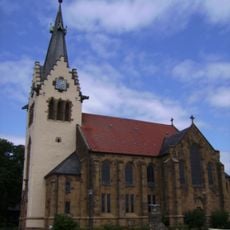
Johannes-der-Täufer-Kirche
3.6 km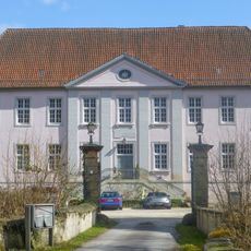
Schloss Palsterkamp
937 m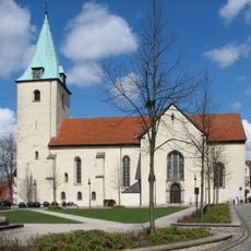
St. Mauritius (Dissen)
2.8 km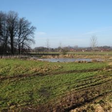
Salzenteichs Heide
4.1 km
Großsteingrab Hilter
3.8 km
Wehde-Berg
3.9 km
Kleiner Berg
2.6 km
Dr.-Bauer-Heimatmuseum Bad Rothenfelde
394 m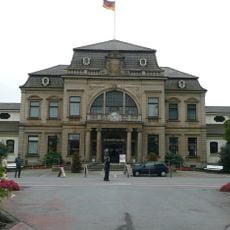
Kurmittelhaus Bad Rothenfelde
99 m
Teutoburger Wald, Kleiner Berg
3.6 km
Work of art, statue
3.1 km
Megalithgrab
3.5 km
Memorial
2.4 km
Konzertpavillon
324 m
Hallenbad Dissen
2.6 km
Neues Gradierwerk
278 m
Wayside cross
3 km
Wegekreuz
755 m
Wayside cross
3.1 km
Scenic viewpoint
1.6 km
Kriegerdenkmal 2 Weltkrieg
1.1 km
Altes Gradierwerk
184 m
Memorial, war memorial
3.7 km
Work of art
112 m
Kriegerdenkmal 1. Weltkrieg
1 km
Memorial
29 m
Gedenkstein Bruce Cogram - Gemeinde Bad Laer 1985
4.1 km
Wayside shrine
4.2 kmReviews
Visited this place? Tap the stars to rate it and share your experience / photos with the community! Try now! You can cancel it anytime.
Discover hidden gems everywhere you go!
From secret cafés to breathtaking viewpoints, skip the crowded tourist spots and find places that match your style. Our app makes it easy with voice search, smart filtering, route optimization, and insider tips from travelers worldwide. Download now for the complete mobile experience.

A unique approach to discovering new places❞
— Le Figaro
All the places worth exploring❞
— France Info
A tailor-made excursion in just a few clicks❞
— 20 Minutes