To see beyond
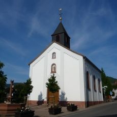
Location: Sankt Martin
Creator: Tim Norris
Creator: Tim Norris
GPS coordinates: 49.30481,8.10849
Latest update: July 20, 2025 17:13
Alsterweiler-Kapelle
933 m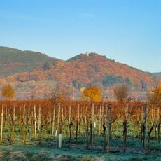
Wetterkreuzberg
899 m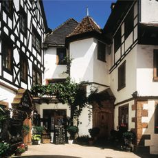
Altes Schlößchen
664 m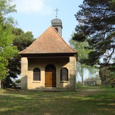
Maria-Schutz-Kapelle
879 m
Haardtrand - Am Wingertsberg
860 m
Haardtrand - Im Dörnel
296 m
Haardtrand - Am Eichelberg
677 m
Alsterweiler Zum Andenken
645 m
Wayside cross, Christianity, Catholic church building
869 m
Wayside cross
650 m
Wayside shrine
608 m
ATELIER rothpauser
685 m
Flurkreuz Christus in der Kelter
712 m
Wayside cross, Christianity, Catholic church building
744 m
Weltkrieg 1 & 2 Gedenktafel
756 m
Wayside cross
785 m
Wayside shrine, Christianity
839 m
Wayside cross
538 m
Wayside shrine, Christianity, Catholic church building
651 m
Wayside cross
481 m
Bildstock
428 m
Wayside cross, Christianity
901 m
Catholic church building, wayside shrine, Christianity
902 m
Christianity, Catholic church building, wayside shrine
924 m
Wanderweg Deutsche Weinstraße
134 m
Catholic church building, wayside shrine, Christianity
948 m
Steinsäule
963 m
Catholic church building, wayside shrine, Christianity
969 mReviews
Visited this place? Tap the stars to rate it and share your experience / photos with the community! Try now! You can cancel it anytime.
Discover hidden gems everywhere you go!
From secret cafés to breathtaking viewpoints, skip the crowded tourist spots and find places that match your style. Our app makes it easy with voice search, smart filtering, route optimization, and insider tips from travelers worldwide. Download now for the complete mobile experience.

A unique approach to discovering new places❞
— Le Figaro
All the places worth exploring❞
— France Info
A tailor-made excursion in just a few clicks❞
— 20 Minutes