Trojanisches Pferd
Location: Bad Münstereifel
Creator: Hans-Peter Lückerath
Made from material: wood
Creator: Hans-Peter Lückerath
GPS coordinates: 50.54660,6.72436
Latest update: November 20, 2025 00:15
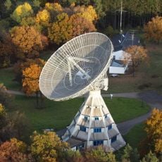
Stockert Radio Telescope
2.5 km
Tempelbezirk Pesch
2.1 km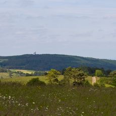
Stockert
2.5 km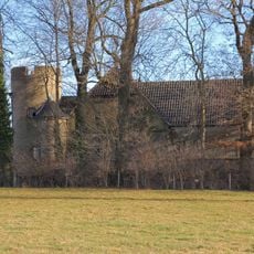
Heistard Castle
2.4 km
Eschweiler Tal und Kalkkuppen
2.2 km
Kalkuppenlandschaft zwischen Wachendorf und Pesch
1.9 km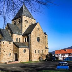
St. Willibrord
252 m
Jüdischer Friedhof (Harzheim)
2.5 km
Jakob-Kneip-Berg
2.4 km
Hals-Berg
1.9 km
Zingsheimer Wald
1.7 km
Eschweiler Tal und Kalkkuppen
2.3 km
LSG-Strukturreiche Kulturlandschaft im westlichen Plangebiet
386 m
Hähnchen
1.8 km
Lamberts-Berg
1.8 km
Kriegerehrenmal
2.3 km
Scenic viewpoint
1.6 km
Wayside cross
1.1 km
Wayside cross
1.1 km
Wayside shrine
2.1 km
Gallo-römische Tempelanlage "Heidentempel"
2.1 km
Wayside cross
993 m
Wayside shrine, Christianity, Catholic church building
987 m
Wayside cross
709 m
Wayside cross
1.2 km
Wayside cross
2.5 km
Wayside cross
648 m
Dr. Hardenberg
2 kmReviews
Visited this place? Tap the stars to rate it and share your experience / photos with the community! Try now! You can cancel it anytime.
Discover hidden gems everywhere you go!
From secret cafés to breathtaking viewpoints, skip the crowded tourist spots and find places that match your style. Our app makes it easy with voice search, smart filtering, route optimization, and insider tips from travelers worldwide. Download now for the complete mobile experience.

A unique approach to discovering new places❞
— Le Figaro
All the places worth exploring❞
— France Info
A tailor-made excursion in just a few clicks❞
— 20 Minutes