The Pulse
Location: County Durham
Creator: Diane Maclean
Creator: Diane Maclean
GPS coordinates: 54.81860,-1.62785
Latest update: November 15, 2025 06:53
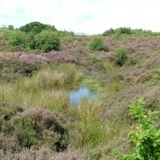
Waldridge Fell
2.7 km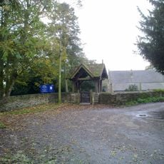
Church of St Michael and All Angels
1.9 km
Pickeran Tomb Circa 8 Metres South Of East End Of Church Of St Michael
1.9 km
Jobling And Hogen Tombs Circa 15 Metres South Of Church Of St Michael
1.9 km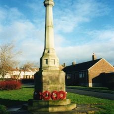
Witton Gilbert War Memorial
932 m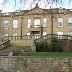
Witton Hall And Wall Attached
1.8 km
Langley Hall
3 km
Clark Tomb Circa 15 Metres South Of West End Of Church Of St Michael
1.9 km
Snaith Tomb Circa 7 Metres South Of Church Of St Michael
1.9 km
Kimblesworth Grange Farmhouse With Wall And Outhouse Attached
2 km
Well House Circa 20 Metres South Of Fyndoune Mews
1.4 km
Broom House Farmhouse
2.5 km
Cottage And Stables Circa 100 Metres West Of Kimbleworth Grange Farmhouse
2 km
New Cinema
74 m
West Edmondsley Farmhouse
2.7 km
Fyndoune And Fyndoune Mews
1.4 km
Kaysburn House
2.2 km
Former Smithy To West Of No 29
1.7 km
Barn At Witton Hall Farm
1.8 km
Hopper Tomb Circa 1 Metre East Of Church Of St Michael
1.9 km
Cartshed Circa 80 Metres North Of Broom House Farmhouse
2.6 km
Holmside Park
2.8 km
Toboggan
2.2 km
Willow Maze
2.4 km
Owl
2.1 km
Mural, Work of art
220 m
Work of art, sculpture
1.9 km
Work of art
163 mReviews
Visited this place? Tap the stars to rate it and share your experience / photos with the community! Try now! You can cancel it anytime.
Discover hidden gems everywhere you go!
From secret cafés to breathtaking viewpoints, skip the crowded tourist spots and find places that match your style. Our app makes it easy with voice search, smart filtering, route optimization, and insider tips from travelers worldwide. Download now for the complete mobile experience.

A unique approach to discovering new places❞
— Le Figaro
All the places worth exploring❞
— France Info
A tailor-made excursion in just a few clicks❞
— 20 Minutes