
Willmore Surface
Location: County Durham
Creator: Peter Sales
Accessibility: Accesible en silla de ruedas
Made from material: granite
Creator: Peter Sales
Website: https://dur.ac.uk/news/newsitem/?itemno=14164
GPS coordinates: 54.76757,-1.57268
Latest update: November 11, 2025 14:19
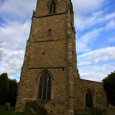
Church of St Oswald
426 m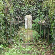
Charley's Cross At West Corner Of Junction With Church Street
179 m
Palatine Reception
124 m
Counts House
409 m
Ice House North Of Count's House
424 m
10, South Bailey
462 m
75, Hallgarth Street
463 m
Wall Behind Nos. 12 And 12a
451 m
37, Hallgarth Street
413 m
54-56, Hallgarth Street
364 m
73, Hallgarth Street
452 m
St Cuthbert's Society
461 m
9, South Bailey
468 m
11, South Bailey
460 m
21-32, Hallgarth Street
458 m
67, Hallgarth Street
416 m
Garden Wall South Of No. 5
468 m
Wall Behind St.john's College From Nos. 1 To 11 Consecutive, And Garden House Attached Behind No.11
437 m
59, Hallgarth Street
379 m
68 And 69, Hallgarth Street
425 m
58, Hallgarth Street
374 m
70, Hallgarth Street
433 m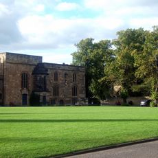
Durham University Library
72 m
What Lies Beneath Us
138 m
Cry For Justice
69 m
Durham Sundial
82 m
St. Oswald's Arch
334 m
Scenic viewpoint
300 mReviews
Visited this place? Tap the stars to rate it and share your experience / photos with the community! Try now! You can cancel it anytime.
Discover hidden gems everywhere you go!
From secret cafés to breathtaking viewpoints, skip the crowded tourist spots and find places that match your style. Our app makes it easy with voice search, smart filtering, route optimization, and insider tips from travelers worldwide. Download now for the complete mobile experience.

A unique approach to discovering new places❞
— Le Figaro
All the places worth exploring❞
— France Info
A tailor-made excursion in just a few clicks❞
— 20 Minutes