Chaldon Church Mural
Location: Tandridge
Inception: January 1, 1170
GPS coordinates: 51.28536,-0.12473
Latest update: November 20, 2025 09:10
Happy Valley Park
1.3 km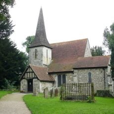
Church of St Peter and St Paul
5 m
Chapel Of St Michael The Archangel, Caterham Guards Depot
1.8 km
Rook Cottage
835 m
Coal Tax post, east side of Coulsdon Road at junction with The Grove
1.7 km
Tollsworth Manor House
1.1 km
Rook Farm House
964 m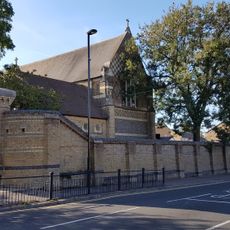
Piers And Walls To Churchyard Of St Michael, Caterham Guards Depot
1.8 km
Cold Blow
865 m
Chaldon Court
57 m
Alderstead Farmhouse
1.4 km
Barn 60 Yards North East Of Dean Farm
1.9 km
Granary To North Of Alderstead Farmhouse
1.4 km
Barn 15 Yards North Of Rook Farm House
956 m
Alderstead Fort
1.8 km
Site of manor house in Netherne Wood
1.6 km
Chest Tomb 25 Yards South West Of Porch Of Church Of St Peter And St Paul
20 m
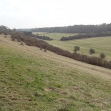
Farthing Downs and Happy Valley
1.6 km
Coal Tax Post, East Side Of Ditches Lane Near Devilsden Wood
1.2 km
Stable South Of Barn And 100 Yards East Of Dean Farm
1.8 km
Yew Tree Cottage
1.8 km
Granary 10 Yards West Of Chaldon Court House
79 m
2 Chest Tombs 30 Yards South West Of Church Of St Peter And St Paul
26 m
Surrey National Golf Club
1.1 km
Southernmost Point of Gtr London
162 m
Scenic viewpoint
965 m
Scenic viewpoint
1.1 km
Scenic viewpoint
1.7 kmReviews
Visited this place? Tap the stars to rate it and share your experience / photos with the community! Try now! You can cancel it anytime.
Discover hidden gems everywhere you go!
From secret cafés to breathtaking viewpoints, skip the crowded tourist spots and find places that match your style. Our app makes it easy with voice search, smart filtering, route optimization, and insider tips from travelers worldwide. Download now for the complete mobile experience.

A unique approach to discovering new places❞
— Le Figaro
All the places worth exploring❞
— France Info
A tailor-made excursion in just a few clicks❞
— 20 Minutes