Grafters Gable
Location: Sunderland
Creator: Frank Doyle
Creator: Frank Doyle
GPS coordinates: 54.89461,-1.37363
Latest update: November 17, 2025 02:46
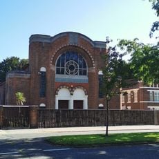
Sunderland Synagogue
326 m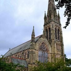
Church of St John and Attached Hall
736 m
1-24, Park Place West
637 m
1-24, Park Place East
626 m
Langham Tower (Sunderland High School)
540 m
Gas Holder At Nz 4080 5544 To East Of East End Of Corporation Road
597 m
17-23, Saint Bede's Terrace
584 m
3-19, Ridley Terrace
494 m
Park Road Methodist Church With School, Walls And Gates Attached
744 m
Walls, Piers And Gates To Gray House
457 m
Carlton House
514 m
Ashburne House, Part Of Backhouse Building Of The University Of Sunderland
422 m
Christ Church Including Attached Vestry And Verger's House
588 m
Churchyard Walls And Gates North And East Of Church Of St John
723 m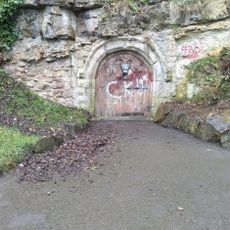
Medieval Arch Under Cliff Near South East Corner Of Park
782 m
Terrace Walls And Piers To Ashburne House
416 m
11, Mowbray Road
533 m
West Hendon House
537 m
Church of St Ignatius
574 m
Numbers 1-16 With Attached Handrails
686 m
1-9 The Esplanade (Terrace) With Steps And Handrails
762 m
Walls, Railings And Gates To Christ Church
570 m
Church House To Church Of St John
720 m
Douro Terrace Including Douro House (No. 7) With Steps And Railings
759 m
Bede Tower
664 m
Piers At North End
721 m
War Memorial South of Christ Church
577 m
Blue House Pub
549 mReviews
Visited this place? Tap the stars to rate it and share your experience / photos with the community! Try now! You can cancel it anytime.
Discover hidden gems everywhere you go!
From secret cafés to breathtaking viewpoints, skip the crowded tourist spots and find places that match your style. Our app makes it easy with voice search, smart filtering, route optimization, and insider tips from travelers worldwide. Download now for the complete mobile experience.

A unique approach to discovering new places❞
— Le Figaro
All the places worth exploring❞
— France Info
A tailor-made excursion in just a few clicks❞
— 20 Minutes