Wennington Village sign
Location: London Borough of Havering
GPS coordinates: 51.50645,0.21908
Latest update: November 23, 2025 19:23
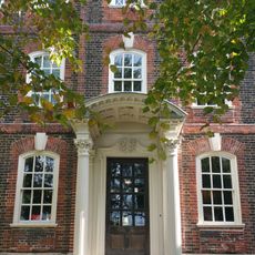
Rainham Hall
2.3 km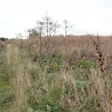
Rainham Marshes Nature Reserve
1.9 km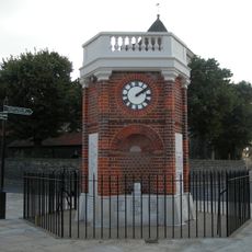
Rainham War Memorial
2.4 km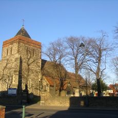
Church of St Helen and St Giles
2.4 km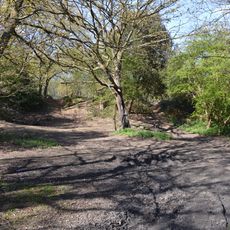
Purfleet Road, Aveley
1.7 km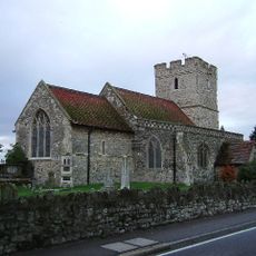
St Mary and St Peter's Church, Wennington
116 m
Wall And Gate Piers To Rainham Hall Between Number 15 And 37
2.3 km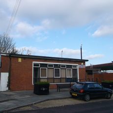
Aveley Library
2.3 km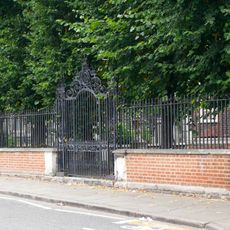
Forecourt railings, gates and piers walls and vases at Rainham Hall
2.4 km
2-8, Upminster Road South
2.3 km
Kenningtons
2.3 km
Bretts Farmhouse
2.1 km
Berwick Manor Country Club
2.4 km
Fanns Farmhouse
2.1 km
Weatherboarded Barn To South Of Bretts Farmhouse
2.1 km
The Willows
609 m
The Lodge at Rainham Hall
2.3 km
Stable Block at Rainham Hall
2.3 km
South Hall Farmhouse
1.1 km
Ingrebourne Links Golf Course
1.1 km
Railing Hall
2.4 km
A million years in Purfleet
2.4 km
Mural, Work of art
2.4 km
Work of art, sculpture
1.6 km
Scenic viewpoint
2.1 km
Scenic viewpoint
1.4 km
Scenic viewpoint
1.5 km
Scenic viewpoint
1.4 kmReviews
Visited this place? Tap the stars to rate it and share your experience / photos with the community! Try now! You can cancel it anytime.
Discover hidden gems everywhere you go!
From secret cafés to breathtaking viewpoints, skip the crowded tourist spots and find places that match your style. Our app makes it easy with voice search, smart filtering, route optimization, and insider tips from travelers worldwide. Download now for the complete mobile experience.

A unique approach to discovering new places❞
— Le Figaro
All the places worth exploring❞
— France Info
A tailor-made excursion in just a few clicks❞
— 20 Minutes