Mr Oakley
Location: Sevenoaks
Creator: Wisewood
Made from material: wood
Creator: Wisewood
GPS coordinates: 51.28028,0.16957
Latest update: July 20, 2025 17:39
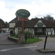
The Riverhead Public House
313 m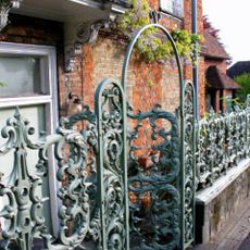
Forecourt Railings And Entrance Arch To The Manor House
330 m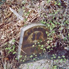
Milestone, Worship Hill, Riverhead, 70m E of Cranmer Road
298 m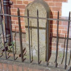
Milestone, Amherst Hill, Riverhead, nr jct with Worships Hill
362 m
Wall To East And South Of Coach House Building
327 m
The Manor House Nursing Home
337 m
Amherst Cottage
276 m
Dovecot In Garden To West Of The Riverhead Public House
304 m
6, Amherst Hill
306 m
8, Amherst Hill
311 m
Old Outbuildings To North West Of The Riverhead Public House
313 m
Wall Running East-West To Form The South Boundary Of Lands Of The Riverhead Public House
263 m
Wall To West Of The Riverhead Public House
318 m
Wall Running Along Road South Of Turning To Montreal Road
225 m
Lions
73 m
Barrow Way Barroway
333 m
Piece Of Wall To South East Of Riverhead House
334 m
Wall Running South, West South West And South Again From North West Corner Of Lane Belonging To The Riverhead Public House
296 m
Riverhead House
339 m
Montreal Lodge
340 m
Forecourt Railings To Riverhead House
352 m
Manor House Cottage
360 m
Dragon
68 m
Retaining Wall Around Front Of Montreal Lodge And Continuing Down Brittain's Lane
374 m
Cade House
401 m
Coach House To West Of No 2 Wall West Of No 2
409 m
7, The Square
411 m
Durham House
420 mReviews
Visited this place? Tap the stars to rate it and share your experience / photos with the community! Try now! You can cancel it anytime.
Discover hidden gems everywhere you go!
From secret cafés to breathtaking viewpoints, skip the crowded tourist spots and find places that match your style. Our app makes it easy with voice search, smart filtering, route optimization, and insider tips from travelers worldwide. Download now for the complete mobile experience.

A unique approach to discovering new places❞
— Le Figaro
All the places worth exploring❞
— France Info
A tailor-made excursion in just a few clicks❞
— 20 Minutes