A Different Ball Game
Location: Tonbridge and Malling
Creator: Kevin Atherton
Creator: Kevin Atherton
GPS coordinates: 51.27436,0.39366
Latest update: November 23, 2025 03:19
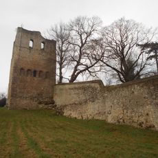
St Leonards Tower
1.6 km
Chapel of St Blaise
1.3 km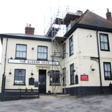
The Queens Head Public House
1.7 km
Yew Tree Cottage
1.3 km
Control Tower
723 m
183, Butchers Lane
1.4 km
Farm Building 20 Yards South West Of The Queens Head Public House
1.7 km
Kitchen Garden Wall And The Bothy To The North Of Mereworth Castle
1.7 km
196 And 198, Butchers Lane
1.4 km
World War II Bofors Anti-aircraft gun tower, Pickett-Hamilton fort and pillbox: part of the airfield defences of RAF West Mallin
899 m
114 And 116, St Leonard's Street
1.6 km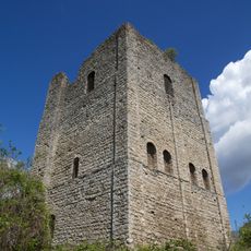
Tower keep castle at West Malling
1.7 km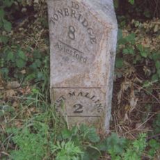
Milestone, Malling Road, N of crossroads with Kent Street, by entrance to log company(Kate Reed Wood)
740 m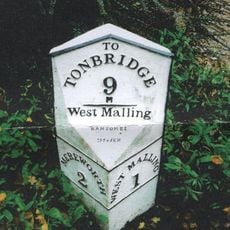
Milestone, King Hill, 300m N of roundabout on W Malling by-pass
904 m
Park Cottages
1.6 km
Forge House
1.6 km
Barn 40 Yards West Of Great Canon Court
1.5 km
Rose Cottage
1.4 km
Holly Cottage
1.4 km
Great Canon Court
1.5 km
Former Airmens Institute
296 m
222 And 224, Butchers Lane
1.4 km
Buildings 10, 20, 30, 50, 60 And 70 Former Barracks
224 m
St Leonard's House
1.4 km
Chestnuts
1.5 km
Gibson Building
145 m
Children Playing Tug of War
611 m
The Obelisk
981 mReviews
Visited this place? Tap the stars to rate it and share your experience / photos with the community! Try now! You can cancel it anytime.
Discover hidden gems everywhere you go!
From secret cafés to breathtaking viewpoints, skip the crowded tourist spots and find places that match your style. Our app makes it easy with voice search, smart filtering, route optimization, and insider tips from travelers worldwide. Download now for the complete mobile experience.

A unique approach to discovering new places❞
— Le Figaro
All the places worth exploring❞
— France Info
A tailor-made excursion in just a few clicks❞
— 20 Minutes