The Prophet
Location: Cotswold
Creator: Willi Soukop
Made from material: stone
Creator: Willi Soukop
GPS coordinates: 51.71331,-1.96469
Latest update: July 20, 2025 17:44
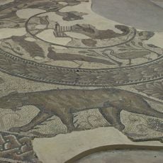
Corinium Dobunnorum
201 m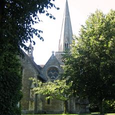
Church of the Holy Trinity
257 m
Chester Villa
132 m
1, Querns Lane
154 m
Bowly's Cottages
95 m
Cotswold Cottage
106 m
50, 52 And 54, Chester Street
247 m
Wall, Railings And Gate Pier Attached To Numbers 23 And 25
58 m
72 And 74, Cricklade Street
196 m
Gates, Doors, Piers And Attached Quadrants Of Wall To Watermoor House
114 m
2, Watermoor Road
144 m
St Johns Almshouses
152 m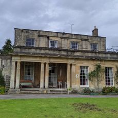
Watermoor House
99 m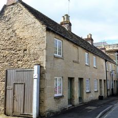
7, 9 And 11, Querns Lane
180 m
Querns School And Attached Garden Wall
183 m
76-82, Cricklade Street
185 m
64, Cricklade Street
223 m
Lock Up In Grounds Of Cotswold District Council Offices
212 m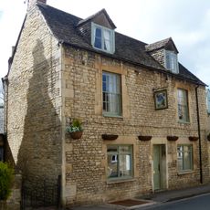
Twelve Bells And Attached Range Of Outbuildings
137 m
Former School And Attached Railings, Master's Houses, Gates And Gate Piers
237 m
3, Querns Lane
166 m
32 Watermoor Road
197 m
Bowly's Almshouses
75 m
Walls Attached To Numbers 28-34
160 m
137, 139 And 141, Cricklade Street
158 m
Wall And Gate Pier Attached To Numbers 16-26
81 m
14, Lewis Lane
133 m
Bowly's Pump
88 mReviews
Visited this place? Tap the stars to rate it and share your experience / photos with the community! Try now! You can cancel it anytime.
Discover hidden gems everywhere you go!
From secret cafés to breathtaking viewpoints, skip the crowded tourist spots and find places that match your style. Our app makes it easy with voice search, smart filtering, route optimization, and insider tips from travelers worldwide. Download now for the complete mobile experience.

A unique approach to discovering new places❞
— Le Figaro
All the places worth exploring❞
— France Info
A tailor-made excursion in just a few clicks❞
— 20 Minutes