Water
Location: Swindon
Made from material: stone
GPS coordinates: 51.54980,-1.80312
Latest update: November 13, 2025 13:47
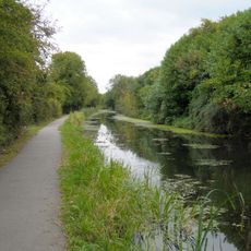
Wilts & Berks Canal
157 m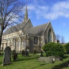
St Mark's Church, Swindon
1.4 km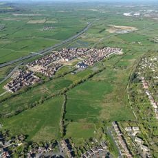
Wichelstowe
784 m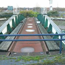
British Rail Engineering Limited Swindon Works Turntable
1.3 km
Bowl barrow 210m north east of Rushy Platt Farm
289 m
Site of watermill 290m south east of West Leaze
549 m
West Leaze Farmhouse
299 m
St Mark's Vicarage
1.3 km
Seymour Clinic, Kingsmill House
1.2 km
Brick Boundary Wall To Former Gwr Works (West)
1.3 km
Number 9 Shop
1.4 km
1, 1A, 2 and 2A, Church Place
1.4 km
Westlecot Manor
1 km
Pattern Store And Water Tank
1.3 km
Great Quarry, Swindon
1.4 km
Cambria Baptist Chapel
1.1 km
Park House
1.4 km
Okus Quarry
962 m
Tree of Life
866 m
Birds in Flight
700 m
Fire
464 m
International Mother Language Day Monument
1.2 km
Stepping Out
372 m
Air
1.2 km
Work of art
1.2 km
Mural, Work of art
771 m
Work of art
1.2 km
Scenic viewpoint
1.3 kmReviews
Visited this place? Tap the stars to rate it and share your experience / photos with the community! Try now! You can cancel it anytime.
Discover hidden gems everywhere you go!
From secret cafés to breathtaking viewpoints, skip the crowded tourist spots and find places that match your style. Our app makes it easy with voice search, smart filtering, route optimization, and insider tips from travelers worldwide. Download now for the complete mobile experience.

A unique approach to discovering new places❞
— Le Figaro
All the places worth exploring❞
— France Info
A tailor-made excursion in just a few clicks❞
— 20 Minutes