River Lea
Location: London Borough of Hackney
Creator: Karc
Creator: Karc
GPS coordinates: 51.54451,-0.02402
Latest update: November 24, 2025 01:15
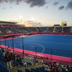
Riverbank Arena
600 m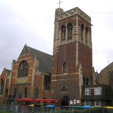
St Mary of Eton
470 m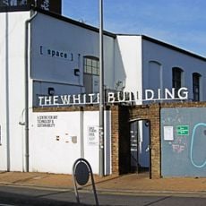
White Building, London
229 m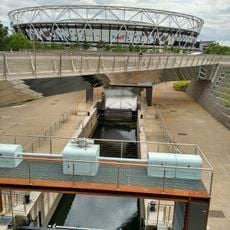
Carpenter's Road Lock
605 m
Gainsborough Primary School
204 m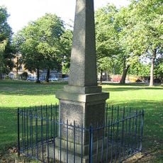
Hackney Wick Great War Memorial
476 m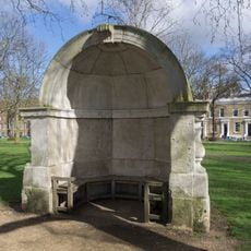
Alcove From Old London Bridge
477 m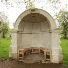
Stone Alcove (On East Side Of Southern Drive And South-West Of Cadogan Gate)
486 m
Tower To North Of Church Of St Mary Of Eton
453 m
Eton House
509 m
Inky Fingers
72 m
History Trees
464 m
Cre8 Centre
488 m
Eve Leibe Gallery
542 m
Mission Hall To North Of Church Of St Mary Of Eton
481 m
RUN
352 m
Paralympic Agitos
467 m
L'Âge d'Or
212 m
History Trees
128 m
Gainsborough School Including Caretaker's House, Outdoor Wcs And Covered Play Areas, Handicraft Block And Special School
211 m
Fishy Island
416 m
The Spark Catchers
527 m
History Trees
590 m
Installation artwork, Work of art, K6 telephone box
539 m
Installation artwork, Work of art, K6 telephone box
543 m
Work of art, mural
176 m
Mural, Work of art
222 m
Work of art, installation artwork
535 mReviews
Visited this place? Tap the stars to rate it and share your experience / photos with the community! Try now! You can cancel it anytime.
Discover hidden gems everywhere you go!
From secret cafés to breathtaking viewpoints, skip the crowded tourist spots and find places that match your style. Our app makes it easy with voice search, smart filtering, route optimization, and insider tips from travelers worldwide. Download now for the complete mobile experience.

A unique approach to discovering new places❞
— Le Figaro
All the places worth exploring❞
— France Info
A tailor-made excursion in just a few clicks❞
— 20 Minutes