Szent István
Location: Tótkomlós
Creator: Mihály Gábor
Creator: Mihály Gábor
GPS coordinates: 46.41172,20.73674
Latest update: November 22, 2025 06:27

Lake Fehér at Kardoskút
11.1 km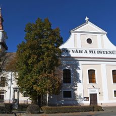
Lutheran Church (Orosháza)
17.2 km
Csanádi-puszták
9.5 km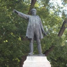
Statue of Lajos Kossuth in Orosháza
17.2 km
Nagy Gyula Museum
17.2 km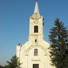
Lutheran Church, Ambrózfalva
6.8 km
Saint George church in Mezőhegyes
12.5 km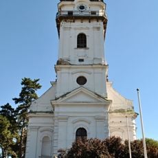
Lutheran Church, Tótkomlós
23 m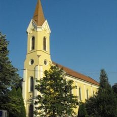
Church of the Nativity of the Virgin Mary in Mezőkovácsháza
11.8 km
Harangláb
9.4 km
Emléktorony
16.3 km
Kőolaj kitermelés emlékműve
11.3 km
I. világháborús emlékmű
10 km
Rózsa Fürdő
98 m
Csomorkányi templomrom
16.3 km
Mária-emlékhely
588 m
Pavel Valaský
63 m
A szabadság lángját magasba emelő leány
8.9 km
Csikóslak - műemlék
13.7 km
Work of art
8.8 km
Work of art, statue
11.8 km
Madárles
11.1 km
Scenic viewpoint
12.7 km
Scenic viewpoint, tower, Observation tower
559 m
Csomorkányi Kilátó
16.3 km
Scenic viewpoint
11.5 km
Scenic viewpoint
17.1 km
Scenic viewpoint
10.7 kmReviews
Visited this place? Tap the stars to rate it and share your experience / photos with the community! Try now! You can cancel it anytime.
Discover hidden gems everywhere you go!
From secret cafés to breathtaking viewpoints, skip the crowded tourist spots and find places that match your style. Our app makes it easy with voice search, smart filtering, route optimization, and insider tips from travelers worldwide. Download now for the complete mobile experience.

A unique approach to discovering new places❞
— Le Figaro
All the places worth exploring❞
— France Info
A tailor-made excursion in just a few clicks❞
— 20 Minutes