Szent Imre
Location: Kistarcsa
Inception: June 1, 1938
Creator: Sidló Ferenc
Creator: Sidló Ferenc
GPS coordinates: 47.54716,19.26126
Latest update: November 20, 2025 17:09

Hungaroring
4 km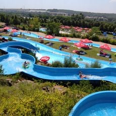
Aquaréna
4.9 km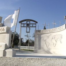
Gloria Victis Memorial
2.6 km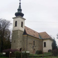
Lutheran church in Cinkota
3.5 km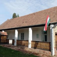
Cinkotai Tájház
3.7 km
Work of art
1 km
Statue, Work of art
2.6 km
Hungaroring Kart Center
3.8 km
Hal csúszda
3.9 km
Kanyarulatok
3.7 km
József Simándi
44 m
Világháborús Emlékmű
4.3 km
Hungaroring
5.4 km
Szent István
2.6 km
Ördög-árok, Csörsz-Árok (római sánc, IV. sz.)
3.9 km
Statue, Work of art
2.5 km
Csokoládékiállítás
4.2 km
Work of art, statue
2.7 km
Névtelen 318 m
5.4 km
Szár-hegy oldal
4.3 km
Scenic viewpoint
2.7 km
Naplás
4.2 km
Amatőrcsillagász észlelőhely (5,29mn darksky), Szt. László kilátó Mogyoród
5 km
Amatőrcsillagász észlelőhely (5,2mn darksky), Naplás-tó ÉK
4.2 km
Scenic viewpoint
4.9 km
Scenic viewpoint
3.3 km
Hungaroring
3.3 km
Waterfall
3.8 kmReviews
Visited this place? Tap the stars to rate it and share your experience / photos with the community! Try now! You can cancel it anytime.
Discover hidden gems everywhere you go!
From secret cafés to breathtaking viewpoints, skip the crowded tourist spots and find places that match your style. Our app makes it easy with voice search, smart filtering, route optimization, and insider tips from travelers worldwide. Download now for the complete mobile experience.

A unique approach to discovering new places❞
— Le Figaro
All the places worth exploring❞
— France Info
A tailor-made excursion in just a few clicks❞
— 20 Minutes