Egy avar kagán sírja
Location: Kunszentmiklós
Inception: January 1, 2008
Creator: Simmer Sándor
Website: https://www.kunszentmiklos.hu/ertektar08.html
Made from material: wood
Creator: Simmer Sándor
Website: https://kunszentmiklos.hu/ertektar08.html
GPS coordinates: 47.02822,19.19170
Latest update: November 20, 2025 07:01
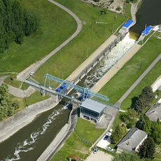
Tass sluice
16.3 km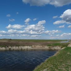
Upper Kiskunság alkaline steppes
5.3 km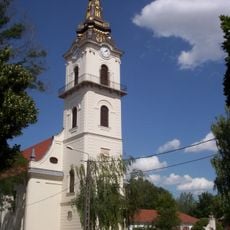
Reformed Church
5.2 km
József Attila Közösségi Ház
17.2 km
Nagy-rét
4.5 km
Kunbaba
7.1 km
Kun Emlékmű
11 km
Árpád-kor keresztje
14.2 km
Madárkapitányok kilátó
17.3 km
Túzok-les Kilátó
9.1 km
Árpád-kori templom romja, Kunbaracs, XIII. sz.
14.2 km
Mántelek Kastély
16.8 km
Avar Kagán sírja
38 m
Kunbaba
17.2 km
Magyarok Országos Gyűlése Bösztörpuszta
8.2 km
Számadó juhász
5.2 km
Kunpeszéri Szalag-erdő Természetvédelmi Terület
13.4 km
Kun Emlékhalom Kunbabával
11.9 km
Work of art
17.2 km
Work of art, sculpture
16 km
Gate, Work of art
3.9 km
Madárles
17.6 km
Tower, Observation tower, scenic viewpoint
13.1 km
Kilátó
7.3 km
Amatőrcsillagász észlelőhely Kunpeszéri kiserdő (7,2mn darksky)
8.7 km
Amatőrcsillagász észlelőhely (6,68mn sötét égbolt), Apaj
11.7 km
Amatőrcsillagász észlelőhely (7,2mn darksky), Kunbaracs pusztatemplom
14.2 km
Amatőrcsillagász észlelőhely Lánci zsilip (7,0mn darksky)
11.4 kmReviews
Visited this place? Tap the stars to rate it and share your experience / photos with the community! Try now! You can cancel it anytime.
Discover hidden gems everywhere you go!
From secret cafés to breathtaking viewpoints, skip the crowded tourist spots and find places that match your style. Our app makes it easy with voice search, smart filtering, route optimization, and insider tips from travelers worldwide. Download now for the complete mobile experience.

A unique approach to discovering new places❞
— Le Figaro
All the places worth exploring❞
— France Info
A tailor-made excursion in just a few clicks❞
— 20 Minutes