Kananaskis Visitor Information Centre
Location: Kananaskis Improvement District
GPS coordinates: 51.04822,-115.02277
Latest update: November 23, 2025 08:45
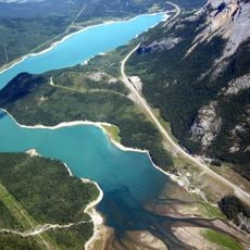
Barrier Lake
3.8 km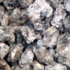
Cardium Formation
10.5 km
Bow Valley Provincial Park
4.4 km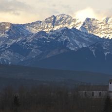
Skogan Peak
10 km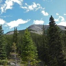
Midnight Peak
7.6 km
Kananaskis Falls
8.4 km
Colonel's Cabin
2.3 km
O'Shaughnessy Falls
6.5 km
Horseshoe Falls
7.8 km
Exshaw Beach
9.9 km
Scenic viewpoint
2.1 km
Star 6 Ranch
3.1 km
Hector Waterfront
3.4 km
Bowfort Waterfront
4.1 km
Brewster's Kananaskis Ranch golf course
6.8 km
Viewing Platform
6.9 km
Scenic viewpoint
4.6 km
Scenic viewpoint
4.7 km
Barrier Dam Day Use Area
2.1 km
Tower, Observation tower, scenic viewpoint
4 km
Scenic viewpoint
3.2 km
Scenic viewpoint
3.5 km
Yates
4 km
Scenic viewpoint
998 m
O'Shaughnessy Falls
6.6 km
Horseshoe Falls
7.8 km
O'Shaughnessy Falls
6.5 km
O'Shaughnessy Falls
6.5 kmReviews
Visited this place? Tap the stars to rate it and share your experience / photos with the community! Try now! You can cancel it anytime.
Discover hidden gems everywhere you go!
From secret cafés to breathtaking viewpoints, skip the crowded tourist spots and find places that match your style. Our app makes it easy with voice search, smart filtering, route optimization, and insider tips from travelers worldwide. Download now for the complete mobile experience.

A unique approach to discovering new places❞
— Le Figaro
All the places worth exploring❞
— France Info
A tailor-made excursion in just a few clicks❞
— 20 Minutes