
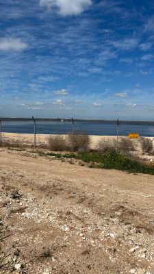
תצפית למאגר
Location: מועצה אזורית לכיש
GPS coordinates: 31.53304,34.82795
Latest update: November 12, 2025 22:33
Pura Nature Reserve
6.6 km
Hazan caves
7.2 km
Tel Nagila
7.4 km
Khirbet a-Ra'i
6.5 km
Mishlat Ma'ahaz
3.7 km
Me‘arot Samakh
2.9 km
Turkish bridge over Pura stream
7 km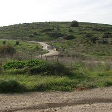
Tel Agra in Nachal Adurayim
5.5 km
Gan Le'ummi Tel Lakhish
4.9 km
Me‘arat Kelekh
5 km
El Ḥabbs
3.8 km
Scenic viewpoint
4.1 km
רסם א־רסום
4.3 km
תל קשת
6.2 km
Philip Carriage Farm
5.1 km
Sheikh Ali
5.6 km
Scenic viewpoint
3.9 km
תל כלך
6.2 km
משלט מאחז
3.7 km
חורבת כרוע
7.4 km
בוסתן רון
4.7 km
גת
4.6 km
מצד מג'ריחי
4.7 km
Ruins
5.9 km
תל ראעי
6.5 km
סוללת המצור האשורי
3.9 km
גשר טורקי
7 km
חורבת מגדל גד
7.1 kmReviews
Visited this place? Tap the stars to rate it and share your experience / photos with the community! Try now! You can cancel it anytime.
Discover hidden gems everywhere you go!
From secret cafés to breathtaking viewpoints, skip the crowded tourist spots and find places that match your style. Our app makes it easy with voice search, smart filtering, route optimization, and insider tips from travelers worldwide. Download now for the complete mobile experience.

A unique approach to discovering new places❞
— Le Figaro
All the places worth exploring❞
— France Info
A tailor-made excursion in just a few clicks❞
— 20 Minutes