
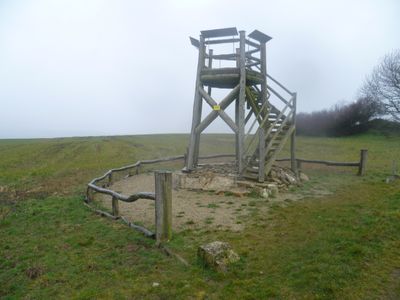
Scenic viewpoint
Location: Ihn
Location: Wallerfangen
GPS coordinates: 49.33310,6.61969
Latest update: November 20, 2025 02:05

Niedaltdorfer Tropfsteinhöhle
1.9 km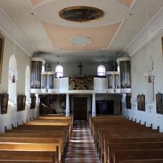
St. Hubertus
1.7 km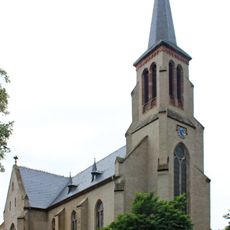
St. Rufus (Niedaltdorf)
2.2 km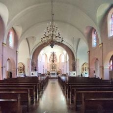
St. Konrad
2.4 km
Gallen-Berg
1.7 km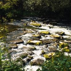
Nied
1.5 km
Landschaftsschutzgebiet im Landkreis Saarlouis - im Bereich der Gemeinde Wallerfangen
160 m
Landschaftsschutzgebiet "Bei Gisingen" (L 6605-302)
1.9 km
Landschaftsschutzgebiet im Landkreis Saarlouis - im Bereich der Gemeinde Wallerfangen [Rehlingen-Siersburg]
863 m
Landschaftsschutzgebiet im Landkreis Saarlouis - im Bereich der Gemeinde Wallerfangen
976 m
Bei Gisingen
1.6 km
Wayside cross, Christianity
1.8 km
Wayside cross
2.4 km
Schluchtblick
727 m
Tropfsteinhöhle
1.9 km
Wayside cross, Christianity
1.9 km
Wayside cross
893 m
Gedenkkreuz
1.4 km
Marienstatue
1.5 km
Wayside cross
2 km
Work of art, sculpture
2.4 km
Reimeringer
1.1 km
Catholic church building, wayside cross, Christianity
2 km
Wegkreuz
1.8 km
Villa Gallo Romain
1 km
Memorial
2.4 km
Wayside cross, Christianity
1.4 km
Wayside cross
1.4 kmReviews
Visited this place? Tap the stars to rate it and share your experience / photos with the community! Try now! You can cancel it anytime.
Discover hidden gems everywhere you go!
From secret cafés to breathtaking viewpoints, skip the crowded tourist spots and find places that match your style. Our app makes it easy with voice search, smart filtering, route optimization, and insider tips from travelers worldwide. Download now for the complete mobile experience.

A unique approach to discovering new places❞
— Le Figaro
All the places worth exploring❞
— France Info
A tailor-made excursion in just a few clicks❞
— 20 Minutes