
Leadgate Maze viewing platform
Location: County Durham
Website: https://www.geograph.org.uk/photo/3871921
Website: https://geograph.org.uk/photo/3871921
GPS coordinates: 54.86214,-1.79595
Latest update: November 14, 2025 20:21

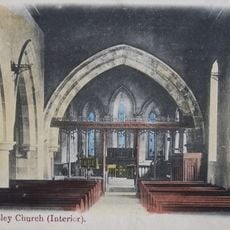
Church of St Mary Magdalene
2.8 km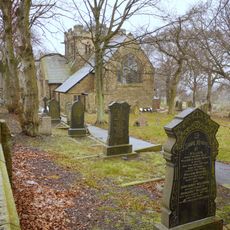
Church of St John
2.5 km
Christ Church, Consett
2.7 km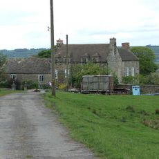
Pontop Hall
2.4 km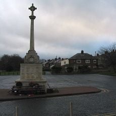
War Memorial at the Civic Centre
2.3 km
Low Woodside Farmhouse
2.7 km
Gate Piers And Gates Of Church Of St Mary Magdalene
2.7 km
Gate Piers And Walls In Front Of Pontop Hall
2.4 km
Tomb Circa 15 Metres South Of Nave Of St Mary Magdalene
2.7 km
Group Of 3 Tombs Circa 3 Metres South Of Nave Of St Mary Magdalene
2.7 km
Board Cottage
1.6 km
Vicarage Of St Aidan
3 km
Church of St Ives
194 m
Stevenson Tomb Clost To Chancel South Wall Of Church Of St Mary Magdalene
2.7 km
Memorial Opposite Number 12 Loud Terrace
2.8 km
Outbuilding West Of Board Cottage
1.6 km
Church of Our Lady and St Joseph
555 m
Church of St Thomas
3 km
Harelaw Watering Place
2.9 km
Rosedale Manor
3.1 km
Iveston War Memorial
1.7 km
Leadgate War Memorial
649 m
Consett & District Golf Club
2.6 km
The Empire Theatre
2.6 km
The Roxy
643 m
The Glass & Art Gallery
2.4 km
Jolly Drovers Maze
268 m
The Old Transformers
1.6 kmReviews
Visited this place? Tap the stars to rate it and share your experience / photos with the community! Try now! You can cancel it anytime.
Discover hidden gems everywhere you go!
From secret cafés to breathtaking viewpoints, skip the crowded tourist spots and find places that match your style. Our app makes it easy with voice search, smart filtering, route optimization, and insider tips from travelers worldwide. Download now for the complete mobile experience.

A unique approach to discovering new places❞
— Le Figaro
All the places worth exploring❞
— France Info
A tailor-made excursion in just a few clicks❞
— 20 Minutes