
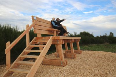
XXL-Baumelbank
Location: Schleiden
Website: https://img.oastatic.com/img2/605592874/max/variant.jpg?revbust=a25ef535
Made from material: wood
Operator: Nationalparkverwaltung Eifel
Website: https://img.oastatic.com/img2/605592874/max/variant.jpg?revbust=a25ef535
GPS coordinates: 50.54525,6.37215
Latest update: November 19, 2025 08:38
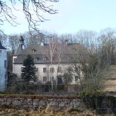
Schloss Dreiborn
3.3 km
St George's church
2.7 km
Wüstebachtal
2.8 km
Bachtäler im Truppenübungsplatz Vogelsang
1.1 km
Buchenwald Dedenborn
1.6 km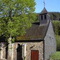
St. Hubertus
2.3 km
Naturwaldzelle Im Brand
2.9 km
Erkensruhrtal mit Nebenbächen und Felsen am Oberseeufer
2.4 km
LSG-Hirschrotter und Erkensruhrer Tal
1.8 km
Viehbachtal westlich Schöneseiffen
3.1 km
LSG-Wald zwischen Erkensruh und Truppenuebungsplatz Vogelsang
1.9 km
Bachtäler im Truppenübungsplatz Vogelsang
1.1 km
Dedenborn, Talaue des Püngel-, Wüstebaches und Erkensruhroberlauf
2.1 km
LSG-Leykaul
722 m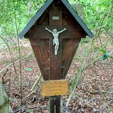
Wayside cross, tourist attraction
3 km
Müsauels-Berg
118 m
Monschau-Hellenthaler Waldhochfläche
3.1 km
Maria-Hilf-Kapelle
3.2 km
Wayside cross
1.9 km
Eifel-Blick Dreiborn
2.6 km
Dörpches Backes
2.3 km
Labyrinth
669 m
Wayside cross
2.7 km
Wayside cross
1.7 km
Wayside cross
3.3 km
Wayside cross
3.2 km
Wayside cross
1.9 km
Wayside cross
2.5 kmReviews
Visited this place? Tap the stars to rate it and share your experience / photos with the community! Try now! You can cancel it anytime.
Discover hidden gems everywhere you go!
From secret cafés to breathtaking viewpoints, skip the crowded tourist spots and find places that match your style. Our app makes it easy with voice search, smart filtering, route optimization, and insider tips from travelers worldwide. Download now for the complete mobile experience.

A unique approach to discovering new places❞
— Le Figaro
All the places worth exploring❞
— France Info
A tailor-made excursion in just a few clicks❞
— 20 Minutes