Information board, high water mark
Location: 豊岡市
Inscription: 平成16年の台風23号によってこの場所は3.2m浸水しました
GPS coordinates: 35.45614,134.77400
Latest update: November 6, 2025 18:56
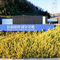
Tajima Kokufu and Kokubunji Hall
1.6 km
進美寺
1.5 km
Statue, Work of art
1.4 km
Statue, Work of art
1.5 km
台風23号被災水深
590 m
Wayside shrine
978 m
Wayside shrine
1.1 km
Wayside shrine
1.2 km
Wayside shrine
1.2 km
C58 170
1.3 km
Wayside shrine
1.4 km
Wayside shrine
1.4 km
Statue, Work of art
1.4 km
Wayside shrine, Buddhism
311 m
High water mark, utility pole
1.5 km
子安地蔵大菩薩
583 m
Statue, Work of art
1.5 km
Wayside shrine
152 m
Wayside shrine, Buddhism
1.5 km
High water mark
1.5 km
Wayside shrine
1.5 km
江原河畔劇場
1.5 km
Work of art, sculpture
1.5 km
日高町民憲章
1.6 km
治水祈念の碑
2 m
Wayside shrine
1.7 km
Wayside shrine
1.7 km
Wayside shrine
1.7 kmReviews
Visited this place? Tap the stars to rate it and share your experience / photos with the community! Try now! You can cancel it anytime.
Discover hidden gems everywhere you go!
From secret cafés to breathtaking viewpoints, skip the crowded tourist spots and find places that match your style. Our app makes it easy with voice search, smart filtering, route optimization, and insider tips from travelers worldwide. Download now for the complete mobile experience.

A unique approach to discovering new places❞
— Le Figaro
All the places worth exploring❞
— France Info
A tailor-made excursion in just a few clicks❞
— 20 Minutes