浸水実績図
Location: 佐用町
Inception: March 1, 2012
Inscription: 平成21年台風第9号災害で、この地点は1.00m浸水しました。
Operator: 佐用町
Color: white
GPS coordinates: 35.00421,134.35593
Latest update: November 16, 2025 09:05
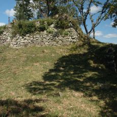
Rikan Castle
5.2 km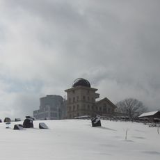
Nishi-Harima Observatory
3 km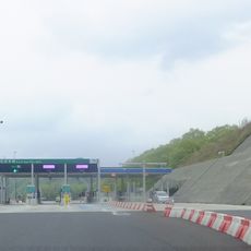
Sayo toll gate
4.1 km
Nishiharima Observatory Park
2.9 km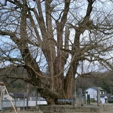
Great Ginkgo of Sayō
598 m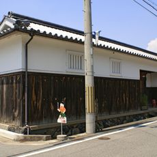
舊田住家住宅
5 km
Kōzuki Castle
4.2 km
Château de Sayo
959 m
武蔵初決闘の場
4.2 km
Scenic viewpoint
4.2 km
佐用スターリゾートゴルフ倶楽部
4.3 km
JOYXゴルフ倶楽部 上月コース
7.6 km
G-style CC
2.2 km
平福の町並み
4.6 km
JOYXゴルフ倶楽部 上月コース
7.5 km
播磨・平福御殿屋敷跡
5 km
Scenic viewpoint
4.4 km
三日月カントリークラブ
8.2 km
Memorial
238 m
平福地域浸水実績図
4.3 km
雲州 松江藩役所並本陣跡
631 m
大広村道路元標
6.1 km
三日月村道路元標
7.6 km
西庄村道路元標
4.2 km
江川村道路元標
5.3 km
平福村道路元標
5 km
尼子勝久公四百年遠忌追悼碑
4.2 km
飛龍の滝
6.3 kmReviews
Visited this place? Tap the stars to rate it and share your experience / photos with the community! Try now! You can cancel it anytime.
Discover hidden gems everywhere you go!
From secret cafés to breathtaking viewpoints, skip the crowded tourist spots and find places that match your style. Our app makes it easy with voice search, smart filtering, route optimization, and insider tips from travelers worldwide. Download now for the complete mobile experience.

A unique approach to discovering new places❞
— Le Figaro
All the places worth exploring❞
— France Info
A tailor-made excursion in just a few clicks❞
— 20 Minutes