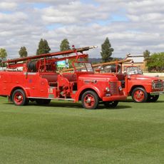
Abandoned Plane
Location: Commonwealth Hill
Location: Pastoral Unincorporated Area
GPS coordinates: -29.64196,133.78191
Latest update: November 21, 2025 21:16

Emergency Fire Service
168.6 km
Tallaringa Conservation Park
101 km
Yellabinna Regional Reserve
170.3 km
Mount Finke
144.3 km
Mount Brady
125.3 km
Pile Hill
127.5 km
Robin Rise
80.2 km
Tom's Working Opal Mine
115.7 km
Scenic viewpoint
144 km
Old Timers Mine & Museum
118.2 km
Opal Cave
118.4 km
The Castle
127.4 km
"Welcome to Coober Pedy" Truck on stilts
117.2 km
Dog Fence
121.1 km
Coober Pedy Opal Fields Golf Club
115.9 km
Josephine’s Kangaroo Sanctuary and Art Gallery
118 km
Crocodile Harry’s Underground Nest
115.5 km
Underground Art Gallery
118 km
Tarcoola Golf Course
140.8 km
The Big Winch
118.1 km
Dog (dingo) fence
131.2 km
Desolate outback road lookout
133.4 km
Film set: Pitch Black Space Ship
117.8 km
Scenic viewpoint
117.8 km
Scenic viewpoint
127.4 km
Scenic viewpoint
127.4 km
Film set: Pitch Black Space Ship
117.8 km
Stuart memorial
118.8 kmReviews
Visited this place? Tap the stars to rate it and share your experience / photos with the community! Try now! You can cancel it anytime.
Discover hidden gems everywhere you go!
From secret cafés to breathtaking viewpoints, skip the crowded tourist spots and find places that match your style. Our app makes it easy with voice search, smart filtering, route optimization, and insider tips from travelers worldwide. Download now for the complete mobile experience.

A unique approach to discovering new places❞
— Le Figaro
All the places worth exploring❞
— France Info
A tailor-made excursion in just a few clicks❞
— 20 Minutes