Wayside shrine
Location: Sankt Veit im Pongau
GPS coordinates: 47.36773,13.08701
Latest update: November 18, 2025 23:03
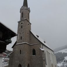
Pfarrkirche hl. Sebastian, Mühlbach am Hochkönig
3.1 km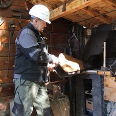
Schaubergwerk Sunnpau
4.2 km
Schneeberg (Salzburger Schieferalpen)
1 km
Pfarrachsteinkapelle
3.5 km
Schaubergwerk Sunnpau (Museumsverein St.Veit / UNESCO-Geopark Erz der Alpen)
4.2 km
Filzkogel
2.3 km
Hochegg
2 km
Bergbaumuseum und Schaustollen
3.2 km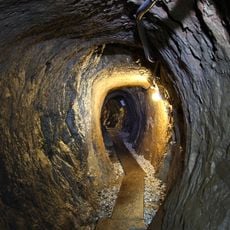
Schaubergwerk Sunnpau
4.2 km
Brennerköpfl
2.3 km
Ahornstein
3.3 km
Brennerköpfl Panoramablick
2.8 km
Gedenkstätte Öhig Raimund
3.3 km
Work of art
1.1 km
Wenger Wasserfall
3.8 km
Bench, scenic viewpoint
2.1 km
Scenic viewpoint
2.7 km
Wayside shrine
2.9 km
Wayside shrine
3.3 km
Wayside shrine
3.1 km
Photo-Point
1.3 km
Wayside cross
2.1 km
Memorial cross, memorial
3 km
Sepp Bradl Denkmal
3.1 km
Wayside shrine
2.7 km
Catholic church building, wayside cross, Christianity
4.1 km
Wayside shrine
3.8 km
Wenger Wasserfall
3.8 kmReviews
Visited this place? Tap the stars to rate it and share your experience / photos with the community! Try now! You can cancel it anytime.
Discover hidden gems everywhere you go!
From secret cafés to breathtaking viewpoints, skip the crowded tourist spots and find places that match your style. Our app makes it easy with voice search, smart filtering, route optimization, and insider tips from travelers worldwide. Download now for the complete mobile experience.

A unique approach to discovering new places❞
— Le Figaro
All the places worth exploring❞
— France Info
A tailor-made excursion in just a few clicks❞
— 20 Minutes