Wayside shrine
Location: Grafendorf bei Hartberg
GPS coordinates: 47.35439,15.96516
Latest update: November 6, 2025 17:43
Schloss Reitenau
2 km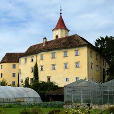
Schloss Kirchberg am Walde
1 km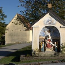
Nischen- /Kapellenbildstock
2.1 km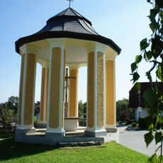
Flur-/Wegkapelle Kirchberger-Kreuz
2 km
Bio-Badesee Sonnenfeld
1.9 km
Einzelbauwerk der Röm. Kaiserzeit, Römerzeitliche Villa Rustica II
2.1 km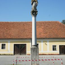
Maria column in Kirchberg am Walde
1.1 km
Gutshof/Meierhof (herrschaftlich), Schloss Kirchberg am Walde
1 km
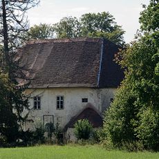
Wirtschaftsgebäude Schloss Reitenau
2 km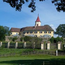
Kirchberg am Walde
1.1 km
Hügelgräbergruppe Lebernholz
2 km
Grabner Kreuz
2.2 km
Catholic church building, wayside cross, Christianity
2.3 km
Patritzbild
2 km
Posch Kreuz
2.1 km
Thorhaggen Kreuz
2.1 km
Hösinger
2.1 km
Wayside cross
1.6 km
Wiesenbauer Kreuz
366 m
Wayside cross, Christianity, Catholic church building
1.3 km
Schieder Kreuz
2 km
Catholic church building, wayside cross, Christianity
2.3 km
Kogler Kreuz
1.8 km
Catholic church building, wayside cross, Christianity
1.5 km
Pfeffer Kreuz
2 km
Wayside cross, Christianity, Catholic church building
1.1 km
Catholic church building, wayside cross, Christianity
946 m
Kirchberger Kreuz
2 kmReviews
Visited this place? Tap the stars to rate it and share your experience / photos with the community! Try now! You can cancel it anytime.
Discover hidden gems everywhere you go!
From secret cafés to breathtaking viewpoints, skip the crowded tourist spots and find places that match your style. Our app makes it easy with voice search, smart filtering, route optimization, and insider tips from travelers worldwide. Download now for the complete mobile experience.

A unique approach to discovering new places❞
— Le Figaro
All the places worth exploring❞
— France Info
A tailor-made excursion in just a few clicks❞
— 20 Minutes