Wayside shrine
Location: Feldkirchen bei Mattighofen
GPS coordinates: 48.06400,13.07227
Latest update: November 18, 2025 10:47

Pfarrkirche Auerbach
2.7 km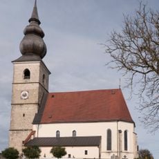
Pfarrkirche hl. Kunigunde, Kirchberg bei Mattighofen
3.5 km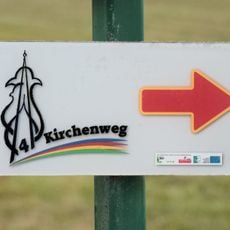
Vierkirchenweg
2.1 km
Filialkirche hl. Stephan, Höring
1.6 km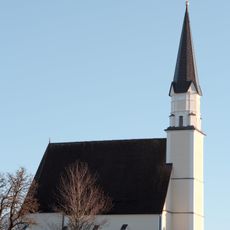
Filialkirche unsere Liebe Frau vom guten Rat in Gstaig
2.4 km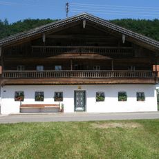
Farmhouse Kaspergut, Feldkirchen bei Mattighofen
1.3 km
Profanbauten, Bräusalettl des ehem. Bräuhauses samt Ausstattung
2.3 km
Strauchbirke bei Auerbach
1.1 km
Hallstatt-Gräberfeld Siedelberg
3.4 km
Pfarrhof
3.5 km
Bajuwarisches Gräberfeld
2.7 km
Kapellen Linde von Unterirnprechting
3.3 km
Memorial
3.2 km
Wayside shrine
3.6 km
Heiliger Martin
3.3 km
Holzkreuz mit Dach und kleiner Christusfigur
3.6 km
Memorial, commemorative plaque
3.5 km
Wayside shrine
3.1 km
Wolfgang Huber
1.8 km
Panorama von Kirchberg bei Mattighofen und Alpenvorland
3.5 km
Dorfplatzerneuerung
2.7 km
Kriegerdenkmal
3.5 km
Wayside shrine
1.7 km
Stark rostige Bildtafel auf Baumstumpf
3.5 km
Friedensbezirk Braunau Landesausstellung 2012
2 km
Christianity, Catholic church building, wayside cross
2 km
Wayside shrine
3.3 km
Waidmannsruh
1.2 kmReviews
Visited this place? Tap the stars to rate it and share your experience / photos with the community! Try now! You can cancel it anytime.
Discover hidden gems everywhere you go!
From secret cafés to breathtaking viewpoints, skip the crowded tourist spots and find places that match your style. Our app makes it easy with voice search, smart filtering, route optimization, and insider tips from travelers worldwide. Download now for the complete mobile experience.

A unique approach to discovering new places❞
— Le Figaro
All the places worth exploring❞
— France Info
A tailor-made excursion in just a few clicks❞
— 20 Minutes