Wayside shrine
Location: Feldkirchen in Kärnten
GPS coordinates: 46.67304,14.06851
Latest update: November 20, 2025 19:20

Pfarrkirche St. Martin am Techelsberg
3.2 km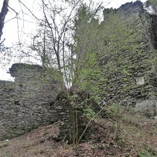
Burgruine Prägrad
2.1 km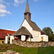
Filialkirche hl. Leonhard, Stocklitz, Feldkirchen
3.6 km
Pfarrkirche hl. Laurentius, Glanhofen, Feldkirchen
2.5 km
Pfarrkirche hl. Nikolaus, Sankt Nikolai
1.4 km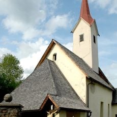
Filialkirche hl Bartholomäus, Techelsberg
3.5 km
Filialkirche hl. Egyd, Dröschitz
3.5 km
Filialkirche hl. Vitus, Ebenfeld
3 km
Kirchengebaeude, Hadanig
2.8 km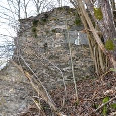
Tevinia castle ruins and fortifications
3.8 km
Gallinblick 2, Glanhofen
2.3 km
Kaplanei Sankt Martin am Techelsberg
3.2 km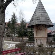
Tschachonigkreuz in Arndorf, Techelsberg
2.8 km
Scenic viewpoint
1.1 km
Wayside shrine
3 km
Scenic viewpoint
1.8 km
Scenic viewpoint
3.3 km
Scenic viewpoint
3.7 km
Tschachonigkreuz
2.8 km
Wayside shrine
1.1 km
Hoher Gallin
2.2 km
Wayside cross
2 km
Wayside shrine
2.3 km
Wayside shrine
2.3 km
Catholic church building, wayside cross, Christianity
1.7 km
Wayside cross
2.1 km
Wayside shrine
1.8 km
Wayside cross
2.9 kmReviews
Visited this place? Tap the stars to rate it and share your experience / photos with the community! Try now! You can cancel it anytime.
Discover hidden gems everywhere you go!
From secret cafés to breathtaking viewpoints, skip the crowded tourist spots and find places that match your style. Our app makes it easy with voice search, smart filtering, route optimization, and insider tips from travelers worldwide. Download now for the complete mobile experience.

A unique approach to discovering new places❞
— Le Figaro
All the places worth exploring❞
— France Info
A tailor-made excursion in just a few clicks❞
— 20 Minutes