Wayside shrine
Location: Anthering
Inscription: no
Made from material: wood
GPS coordinates: 47.88549,13.00689
Latest update: November 19, 2025 00:11
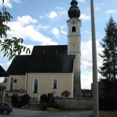
Pfarrkirche Mariä Himmelfahrt
663 m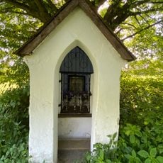
Kapellenbildstock
3.3 km
Sandkuchl
2.9 km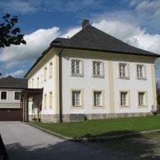
Pfarrhof
753 m
Wohnteil des ehemaligen Bauernhauses
3.3 km
Wohnteil des ehemaligen Bauernhauses
3.1 km
Bildstock aus Holz mit Mutter Gottes und Jesus auf dem Arm
1.9 km
Catholic church building, wayside cross, Christianity
2.6 km
Wildschweinbeobachtungspunkt
1.4 km
Scenic viewpoint
1.5 km
Scenic viewpoint
3.1 km
Catholic church building, wayside cross, Christianity
1.4 km
Christianity, Catholic church building, wayside cross
1.8 km
Wayside cross, Christianity, Catholic church building
2.7 km
Gabrielen-Aussicht
3.3 km
Christianity, Catholic church building, wayside cross
508 m
Catholic church building, wayside cross, Christianity
2.9 km
Scenic viewpoint
1.5 km
Wayside cross
3 km
Schlichtes Holzkreuz
2.6 km
Wayside cross
3 km
Denkmal Gabrielen-Aussicht
3.3 km
Hier erlegte Friedrich Mayr Melnhof am 1. August 1940 seinen 1000 Rehbock
1.4 km
Memorial
3.2 km
Wayside shrine
3.2 km
Catholic church building, wayside cross, Christianity
2.3 km
Jesus-Marterl
3.1 km
Wayside cross
2.7 kmReviews
Visited this place? Tap the stars to rate it and share your experience / photos with the community! Try now! You can cancel it anytime.
Discover hidden gems everywhere you go!
From secret cafés to breathtaking viewpoints, skip the crowded tourist spots and find places that match your style. Our app makes it easy with voice search, smart filtering, route optimization, and insider tips from travelers worldwide. Download now for the complete mobile experience.

A unique approach to discovering new places❞
— Le Figaro
All the places worth exploring❞
— France Info
A tailor-made excursion in just a few clicks❞
— 20 Minutes